
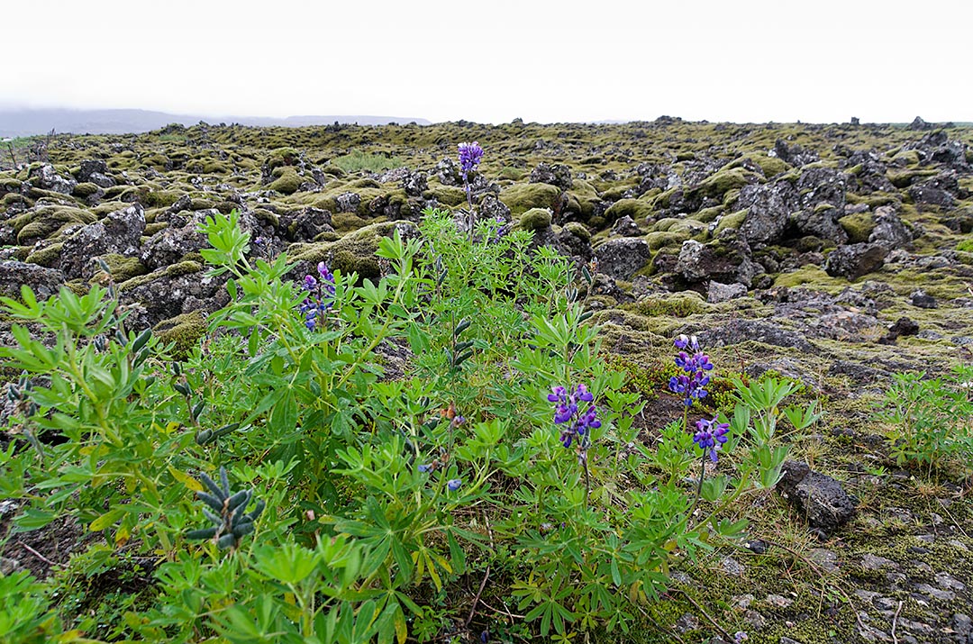
Reykjanes peninsula
As we left Iceland the weather started to improve. Unfortunately for us, our three days here were not the best, especially because we wanted to see the beautiful scenery (what we did see was very nice) of the countryside. Though it continued to be very windy today, at least it wasn’t raining and we could see the odd bit of blue sky.
We left Privileged B & B and at the suggestion of our hosts, Frances and Ian Sykes drove around the Reykjanes peninsula. The scenery is nice, and occasionally you get views out to the ocean, though you never get very close.
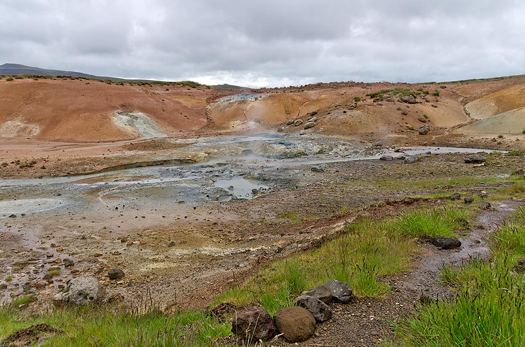
Seltún thermal area
We first stopped to photograph the landscape near Kleivarvatn Lake, a landlocked lake that according to our tourist information map has been dropping in level since a large earthquake in 2000. Just past the lake is the Seltún thermal area. The ground is coloured yellow from sulphur deposits (they mined sulphur here in the 18th and 19th century). Several craters have been formed by the explosion of superheated ground water, the latest in 1999. There are a few spouting fumaroles and small boiling mud pots. It was amongst the most active natural thermal features we’ve seen in Iceland, and since it wasn’t raining we walked around many of the thermal features on the board walks.
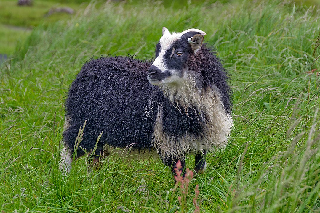
Icelandic sheep
We drove about a kilometer off the main road looking for Krísuvíkurkirkja, a church that was built in 1857. We couldn’t find anything, except a few stone foundations and a wooden cross (which looked like a grave site). I have since found that the church burned down in 2010. I did however get some good closeup pictures of the Icelandic sheep which were in the churchyard.
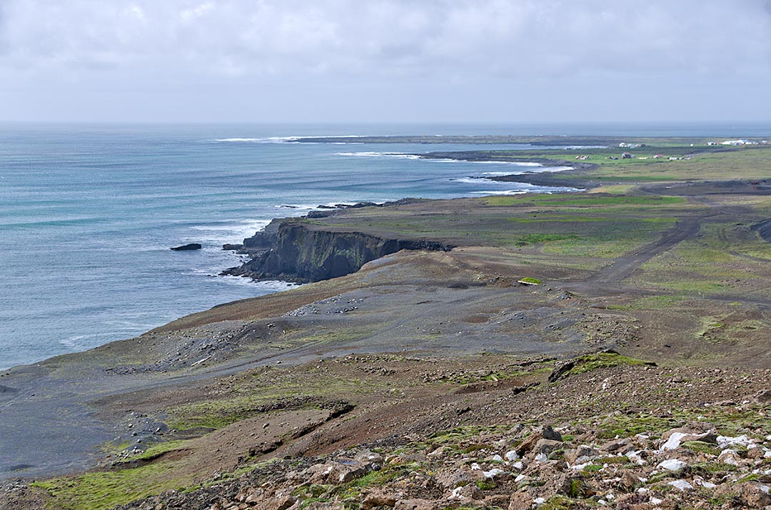
Grindavik
You get a good view out over the ocean as you approach the town of Grindavik. Driving from the east you rise over a large hill, which drops down on the west side towards the town. We saw several cyclists coming up the hill. It is pretty steep, probably about a 10 -15% grade, and most of them eventually dismounted and walked up the hill.
There is a campground in Grindavik. A few people were there in tents. One large truck, which looked something like a camper with large outdoor kitchen facilities, was there and a man and woman were packing up several orange tents. We assumed that perhaps it was the support vehicle for the cyclists we had passed earlier. We ate at a picnic table here, with our backs to the wind, since it was now sunny.
After lunch we drove north to the Blue Lagoon (which is really the hot water outflow from the Svartsengi Power Station). Our hosts at the B & B suggested that it wasn’t a great place to visit on a windy day, since the wind kicks up chemically laden spray from the water, and it will sting your eyes. We didn’t really have enough time to visit and still catch our plane anyway, but we thought we would take a quick look. However, without paying for an entrance ticket you can’t see the main lagoon, so we skipped it. There is some blue overflow water outside the main complex, and it is a very pretty turquoise blue. Supposedly the hot water, which contains sulphur and silica is good for psoriasis, but I suspect that like other hot spring claims to cures around the world it is largely psychosomatic.
We continued our drive around the peninsula, but didn’t really have much time left to stop. It would have been nice to walk to the Reykjanes lighthouse and see the ocean and Eldey Island (where the last Great Auk was killed in 1844). We could see them both from a distance when we drove down the road towards the Reykjanes power station.
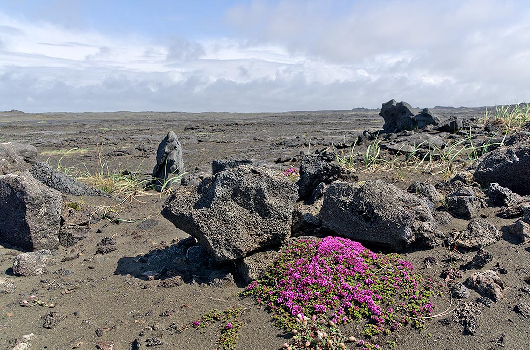
Reykjanes peninsula
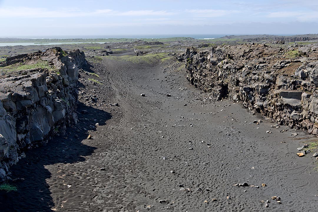
Continental rift
As you continue north along the road you occasionally spot some bright stainless steel spheres, which are used to mark the position of the planets in relation to the “sun” which is centered at the power station. The country here is an old lava flow. It reminded us very much of the land around Kona, Hawaii, except that it is green and covered with moss and other short vegetation. Our last stop along the road was at the “Bridge over two continents” which is a short walkway over a large rift in the ground which is the continental rift between the North American and Eurasian tectonic plates.
We reached the airport at 2pm, as planned, turned in the rental car, and walked the 400 m to the airport. We bought two sub sandwiches to eat on the plane, and then waited in the departure area of the airport for about an hour. Enid thought we should go to the boarding area, but I thought we still had lots of time so wasn’t in a great rush to do so (we had comfortable seats here, and in our previous experience here in Iceland on the way in, there didn’t seem to be much seating at the gate). It was a good thing that we followed Enid’s advice, as we didn’t realize that we had to pass through passport control on the way out, and there was a very long lineup. There definitely wasn’t much seating in the gate area, though we each got a chair. After going through the gate we had another wait, this time in an area with a bit of seating, until we finally got on the plane.
Enid managed to sleep on the way home. I didn’t. We were very surprised when Arden met us at the airport, as we’d assumed we’d have to get a taxi. We visited with Arden and Barb in Leduc, before going to bed early (and then waking up at about 3 am the next morning, as we are almost 10 hours jet-lagged from the time we left St. Petersburg).