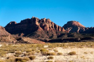
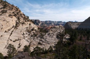
Today is our last in Zion, so we travelled to the west side of the park and drove north on the Kolob Terrace Road. This road climbs to the highest point in Zion National Park, the Lava Point observation area. As it climbs it travels through a large variety of different terrain, and winds in and out of the park through ranchland, so we got a good view of the area. This side is a high plateau, rather than the canyon which we are in here in the main part of the park. You can see out over the entire park, but you are looking down on the canyons, rather than up at them.
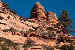
We stopped at the start of the Hop Valley Trail, where there are some very interesting hoodoos. I’d found it on the Internet last night, and it was called “Hoodoo City” in one trail guide. We climbed all around the sandstone and took a lot of pictures. On the way back I stopped to photograph some Stellar’s Jays. Enid was behind me, and discovered some ice in a little creek that we crossed. When I was done photographing I looked around, and couldn’t see her, so thought that she had gone back to the Tahoe. I walked back and she wasn’t there. I called, but she didn’t answer. So I walked back, and found her waiting for me. She’d sat down to wait quietly while I was photographing, and I couldn’t see her.
After eating lunch there we drove on and stopped a lot to take pictures of the magnificent rocky scenery. There is so much red and white sandstone here that you get a different beautiful view around every corner. It is hard to stop photographing! We drove to Lava Point, which is a few miles down a rough gravel road. After that we continued on an even worse road that headed towards the West Rim trailhead. After a while on this road we decided it was pointless, as it was very rough and heading downwards, so we felt we likely wouldn’t get much of a view.
We drove as far as the Kolob Reservoir. Around this area there are quite a few summer homes. None of them were too large and spectacular that we saw, but most of them would have a nice view out over the park. A couple of them were under construction. On the way back we met an oversized semi coming up around the corner. He stopped as he turned and was way over the sharp bend. We had to go out over the edge of the road to get around him. The road is paved, but very narrow, and it reminded us a lot of the roads we drove on through the Snowy Mountains in Australia last year, with similar sharp turns and steep drop-off over the unprotected edge.
Our final stop of the day was at the Wildcat Canyon trailhead, where we decided to hike in on the Northgate Peaks trail. Fortunately this trail was pretty flat. It passes through a large open stand of Ponderosa Pines. After almost 4 kilometres of walking we got to the end which looks out over the park towards the area of the “Subway” canyon. After that we drove back to Springdale where we got fuel, and a few groceries, and so are all ready to leave early tomorrow morning.


