There was almost no wind this morning, a very light haze of clouds, and cool temperature when we left on a hike to the prairie dog down along the Buckhorn Trail. It is about a kilometre from our campsite to the trailhead, and then another 3.6 km to the town, through prairie that skirts along the edges of the coulees.
At least it would have been that far had we not lost the trail in the middle and walked almost an extra kilometre trying to find it again. Near the middle of the trail we went down a small coulee to a nearly dry streambed, and then the trail forked. The main trail seemed to go to the right, so we followed it, but it soon petered out and was nothing more than an indistinct animal trail. We retraced our steps to the top of the hill, and could see a couple of sign posts off in the distance to the left. However, we couldn’t see any sign of a trail that way. After walking back a way on the trail to prove that we hadn’t missed an earlier fork we returned along to the bottom of the coulee, went to the left, crossed the dry stream bed, and followed a very indistinct trail through the grass that did pass the signposts. After about another kilometre we met up with a much better trail coming in from the Caprock Trail parking area, and a clear signpost that indicated it was about another 800 metres to the prairie dog town.
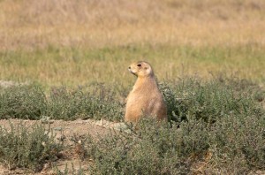
We spent about an hour in the town photographing the prairie dogs. They were large and fat and not very frightened of us. We were able to approach quite closely. Occasionally they would jump high in the air and bark, but they were not very noisy. They mostly sat and ate the grass by pulling it out by the roots, while watching us to make sure we didn’t get too close. If we did then they would scurry away a short distance and continue eating.
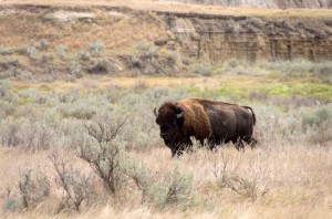
It was too early to eat lunch here, so we walked back to the junction On the way back we saw a huge male bison, only about a hundred metres away. He walked slowly by us without paying much attention, as we watched. Then we took the Caprock Trail which starts with a kilometre long nature trail, so we picked up a trail brochure and followed this trail to where the nature trail portion ends. Here we ate our lunch, then returned back. By now it was quite cloudy and almost looked as if it could rain. It didn’t fortunately, as the clay trail would be extremely slippery if it was wet.
We made an arrow on the ground crossing the wrong trail, out of stones, and pointing in the correct trail direction at the junction where we’d made the mistake in the morning. As we finished this a man came up the trail following after us. He was trying to get to the prairie dog town on the Buckhorn Trail, but was going completely in the wrong direction, so we told him how to get to it.
When we got back to the campsite we had new neighbours. They came by and we talked to them for some time. They turned out to be retired teachers from Wisconsin, and the man was a former band teacher. They told us about their travels, and we ours (we have travelled a lot more than they have). They did tell us about Rocky Mountain National Park in Colorado, and we thought about going there after Grand Teton, but we decided it will probably be too cold this late in the year, so will not go there this time.


