It began to rain last night, and it poured heavily for at least an hour. It was just about the time most people were starting to build campfires for the evening, so the campsite quieted down very quickly. It then rained off and on, but ended sometime before morning. It was cloudy dull but dry as we packed up and drove towards Taber.
After fueling at Taber we tried to contact this park, but the office wasn’t open on Saturday. We drove on to Milk River where there is a large Travel Alberta site (designed to capture Americans as they cross the border). The young female clerk didn’t have any more luck than us, though she tried to get information about the park by Internet and phone. The only real concern was that the park website showed the campground full. We didn’t think that was credible at this time of year, and that it was just a reflection of the fact that the campground is not reservable after the September long weekend.
It turns out that our assumption was correct, for the park was fairly empty when we arrived here shortly after 12:30 (now this evening it isn’t more than half full). I had some difficulty getting the trailer into the campsite, so drove around the loop a second time to change the angle at which I was approaching it, and had success on my second try.
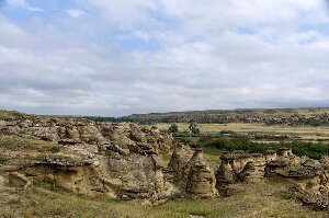
After the trailer was set up we went for a hike along the Hoodoo trail. We had picked up some brochures about the trail and the rock art from the campground host; however, we had a bit of trouble locating where the trail actually started. Once we got our bearings, we followed the trail, which climbs up and down through the hoodoos, along the bank of the river. At times the trail is steep and goes through narrow openings between the rocks, just wide enough to get through with a backpack on. Many of the steepest parts have steps cut into the sandstone, and at one of them there was a handrail.
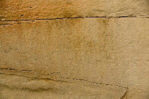
The hoodoos themselves would be a very pretty hike, but there are also a few places along the trail where you can see petroglyphs and pictographs. At the first of these sites there are a few carvings in the sandstone about 10 feet from the ground (if there were lower carvings they would likely have been obliterated by modern graffiti artists scratching their names overtop). The most impressive site though is the “Battle Scene” which is a very large drawing with many, many pictographs of a First Nations battle between two or more warring tribes, sometime around 1866. The drawing shows a large number of men with guns, two camps with teepees, and two opposing forces shooting at each other.
Past this part the trail climbs up a long sloping hill to a viewpoint that overlooks the Milk River Valley and the old site of a NWMP post. The post was set up in 1887 (on a site where the Mounties had originally arrived in 1874), and used as a border patrol post along “Police Coulee” which runs southwards and crosses over into Montana. The post was finally abandoned in 1918.
After supper this evening we walked to the beach area on the Milk River which is very close to our campsite. They must have a lot of trouble with beaver here, for the entire campsite is fenced, and signs along the fence remind you to close the gates to keep the beavers out of the park.


