There was a very pretty sunrise this morning. The only other campers in the campground were also up early this morning, and they were taking pictures of the sunrise over the lake. We left at 7:30 am, drove through Helena without stopping and bought gas in the small town of Townsend. We noticed what seems to be a nice forestry service campground along the Missouri River, right on the outskirts of Townsend, and thought it might be a nice place to stay in the future.
We got to Bozeman about 9:30, and first went to McDonald’s to use the wifi (and get a cup of coffee). After catching up on emails, we went to the REI store, where we bought some clothes, and I got a new pair of hiking shoes. They had an interesting wood burning stove there, which uses heat from the fire to generate electricity, charge the battery which runs a fan, and also can be used to charge USB devices. I was tempted to buy one, but after reading several reviews on the Internet decided against it. It does seem like a neat idea, but apparently you have to keep stoking it up with wood constantly, which doesn’t work so well when you are cooking on it.
There is a fair amount of construction taking place on Highway 191 south of Bozeman. We had to wait for pilot cars twice so it took us some extra time to get to our campsite here at Red Cliff. We weren’t sure where the site was, and the directions we had didn’t mention that it is just south of the town of Big Sky. If we’d known that we’d have been a lot more confident we were heading in the right direction. We did find the site, and it’s clearly marked with a highway sign. As we learned later tonight from the campground hosts it also has a newly constructed left turn lane.
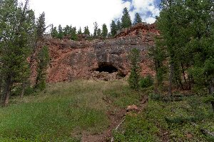
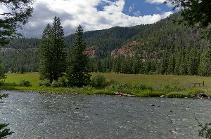
We hiked for a couple of hours south along the river. It is obvious why this is called Red Cliff campground, as right where the trail starts is a high red cliff with a large cave. The trail that leaves from the end of the campground eventually joins with trail 165, which is marked on my topographical maps. We didn’t have time to go to the end of the trail, which runs for several miles back into the mountains, but did follow it for a few kilometres. At first the trail follows the river, then it goes up a switchback for a while (we were worried that it was just going to be a steep hike up the hill), but it soon flattens out, and was a nice pleasant hike through some large trees. We saw a lot of wolf scat with lots of hair in it along the trail.
There are a lot of very large old trees in this campground. Many of the trees here have one or two plastic “buttons” in a strip of plastic about 2 inches by 4 inches long nailed to them. It is some type of insecticide that is being applied to the trees to minimize the effect of parasites (pine beetles?).


