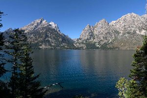
Jenny Lake, September 20

image

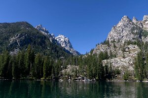
Jenny Lake

It was a beautiful sunny day today.  Though the morning was cold, below freezing, by afternoon it warmed up to a comfortable temperature.  It was one of the nicest days we’ve had since arriving in the Yellowstone area.

We drove up the five mile road to Signal Summit and took pictures of both the Tetons in the west, and the Snake River Valley to the south.  The best views were from the Jackson Lookout, though the road continues on to a higher point about one mile farther.  There was a cell phone tower at the top of the hill, so sitting right under it, it was no problem to post yesterday’s blog, and catch up on our email.  We haven’t had very strong cell signals anywhere in the Yellowstone and Teton areas.

image

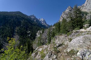
Cascade Canyon

Our plan for the day was to take the boat across Jenny Lake, and we arrived at the dock about 11 am.  Tickets are reasonable, $20 for the two of us round trip, and cut off a total of four miles of walking.  The trip on the boat took about fifteen minutes across the lake, and there were some very nice views of the Teton mountains, and Cascade Canyon.  It is about a 200 foot climb up to Hidden Falls, and the trail is wide, and very busy.  After the falls we continued on to Inspiration Point, another 200 foot climb, but this time on a much narrower rocky trail that switchbacks up the side of the cliff.  We stopped and ate our lunch about half way up at a spot with a very nice view into Cascade Canyon.

image

Cascade Canyon from Inspiration Point

Continuing on after lunch, not far from the top we met a man who asked if we had been up before.  He was carrying a tripod and suggested that it wasn’t worth it, the trail being narrow and exposed.  That didn’t do much for Enid’s confidence, but we made it to the top, and it wasn’t really too bad.  On the way down I commented to Enid that we’d met someone who was more afraid of heights than she is!

After taking pictures at the top which has a very good view out over the lake we started back down.  The trail is rough, with a lot of steps carved into the rock, and it wasn’t easy on Enid’s knees.  As we arrived at the dock one of the boats was just unloading passengers, and we thought we would get on right away.  However, the boat didn’t pick anyone up, but instead headed up the lake with only a couple of people on board.  We had to wait another twenty minutes for the next boat.

From Jenny Lake we headed south to the Moose visitor center, where we used the WiFi to check on where we go after leaving this park.  We decided not to make a reservation at one of the Utah State Parks, since there seemed to be lots of vacant sites.  We will see where we end up on Sunday when we leave, and will just stop wherever it seems convenient and we find a good campsite.

Heading back to our campsite at Colter Bay we stopped at the Menor Ferry site which is just north of the visitor center at Moose.  There are a few historic buildings here, including one cabin belonging to Maud Noble which was where the organizing meeting to set up Grand Teton National Park took place.

Posted in Going South, 2013 | Comments Off on Jenny Lake, September 20

Phelps Lake, September 19

image

The Tetons

It was cold overnight, though it didn’t appear to have frozen.  However, inside our cupboards, on the ceiling, there was heavy condensation everywhere that there is a rafter in the roof of the trailer.  We tried to dry it off as best we could, and left the cupboards all open when we were away today.  It has been so very wet for the last few days, that there is a lot of moisture in the air.

We drove south on the Teton Park Road, stopping at a few spots along the way.  The clouds were starting to break, though it was still very cloudy in the mountains.  We visited the Chapel of the Sacred Heart, then drove to the Jenny Lake visitor center.  We found out how much the boat costs to cross the lake, but decided we would wait until tomorrow, as it was still cloudy, obscuring the Tetons, and the forecast for tomorrow is much better.  Farther down the road a lot of cars were parked off the side of the road, and we stopped to find a large herd of elk, 32 females and one bull.  He had collected an enormous harem, and strutted back and forth amongst them.

image

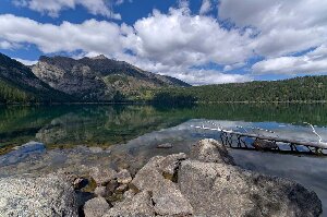
Phelps Lake from Huckleberry Point

We went down the very narrow road to the Laurance S. Rockefeller preserve, and walked in to Phelps Lake.  There was a very large amount of fresh bear scat full of berries all along the trail in the area of the visitor center.  As we got farther along the trail there was less; however, when we got to the lake we saw a brown colored black bear walking down the trail.  We talked and yelled at the bear, and it knew we were there, but just kept walking slowly along the trail.  We followed it for at least a mile on the trail, keeping it about 100 yards ahead of us.  It walked so slowly that we got cool, but we didn’t want to get any closer.   Enid had put on her fleece, then she thought that something was wrong with her knee brace.  It seemed to be pinching her, so she unzipped her pant legs, and found that there was a yellow jacket wasp above her knee, and that it had stung her on the back of the leg.  How it ever got up her pant leg that high is beyond us!

We could hear people talking on the trail ahead of, and we kept yelling “Hello Bear.”  When they saw the bear we heard them talking to it.  The bear then walked off the trail towards the water and passed them, then came back onto the trail again.  It continued to walk slowly along the trail as we walked behind it.

A while later we saw some people farther ahead of us, also coming our way.  They too saw the bear, and yelled at us.  We yelled back that we knew it was there.  After a minute or so they started walking towards us, and when we met they told us that the bear had gone up the hill.  That was the last we saw of it, though we kept talking loudly, and looking back to make sure it wasn’t following us.

We hadn’t wanted to eat lunch while following the bear so we kept on walking to the end of the lake.  There were several groups there eating as well.  One of them walked along the shore, which is a sandy beach, for about half a mile, then later we saw them coming back.  They told us that it was not the correct way to go, and they returned back along the trail we had come from.  The trail had been very clearly marked all along to this sandy beach, but here there was only a small sign that said “Valley Trail”.  That was not the trail we wanted according to our map, but it was the only one we could see.  We followed it for a while, but it seemed to be heading the wrong direction, so we turned back.  But we couldn’t find anything that went any other way, so we decided we’d return to it and follow it for a way and see where it went.  The trail did turn after a while and followed the direction we thought we should be travelling, and not long after that we met a park ranger coming towards us.  She told us that, yes, the trail did continue on and we would soon come to a junction.

image

Death Canyon

We walked up the trail at this junction to see Death Canyon.  We also walked out to Huckleberry Point which had some of the best views of the lake.  The entire hike today was a very pretty walk as the leaves have started to turn color.  The small shrubs are bright reds and yellows, and the poplars have started to turn to gold.

When we got back to the visitor center there was a great buzz amongst the people about “a bear in the tree.”  We saw a fairly large cinnamon bear up on top of the bushes about ten feet high, eating the berries.  Finally he crashed down to the ground and disappeared.  After that we went into the center, which is a beautiful building, and watched the displays of photography of the park.

All the area where we walked today was at one time owned by the Rockefellers.  They accumulated over 30,000 acres of land in this area and donated it to become part of Grand Teton National Park.  Their philanthropy preserved this very beautiful area.

image

Grand Teton

By late afternoon the sky contained only scattered clouds.  We finally got our first view of the top of Grand Teton mountain.  The Tetons are really a spectacular view.

Posted in Going South, 2013 | Comments Off on Phelps Lake, September 19

Grand Teton National Park, September 18

image

It was much colder this morning as we left from Grant Village in Yellowstone.  Although it wasn’t freezing the temperature was about 3 C when we left this morning.  As we drove south into Grand Teton National Park we drove in rain, and at one point, a very little bit of sleety snow.  However, as we got farther into the park the clouds began to break, and we could see the snow covered peaks of the Teton mountains.

We are camping in the Colter Bay campground until it closes on Sunday, September 22.  As we were registering there was a trailer, just a bit smaller than ours, in front of us, and it had stickers on it from several national parks that they have visited.  When we pulled in to get water, they were also filling up, so we talked to them a bit, found out they are from Minnesota, and are soon going home.  They have been to many of the same areas we have in the Dakotas and Wyoming.

We got into our campsite (with considerable difficulty, as it is narrow, there are big log barricades on the side, and it has a bit of a turn – but we squeezed in) and the other couple from Minnesota is camped right across from us.  There was a big puddle in the place where the hitch meets the truck, and so it was rather awkward to unhook without falling into the water!  After we got the Tahoe unhitched, I used the pail and baled water out of the big mud puddle.  My back is a bit sore tonight.

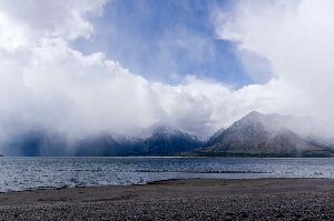
After lunch we hiked first around the Coltor Bay Nature Trail, except it isn’t much of a nature trail, as there were no interpretive signs, as our hiking guide book states there are.  It would be a nice easy walk when the flowers and plants were blooming.  Jackson Lake is very low (it is used for irrigation) and so the water is a long ways out from shore.  The marina is completely dry, and the docks are resting on the dry bottom.  As you walk along the shore it smells much like the ocean, presumably from decaying vegetation in the rocks.  Across the lake we could see the Teton mountains, though the tops were almost obscured by clouds.  It sprinkled rain a couple of times, and it wasn’t really warm, except when the sun poked through the clouds, when it was quite pleasant.

image

We then walked a loop trail that goes by Swan Lake and Heron Pond.  This was a much prettier trail than the nature trail.  Both the lake and the pond are covered with pond lilies.  Though they are not blooming, the leaves were an attractive green and gold in fall colors.  The tops of the Teton mountains were occasionally visible across Heron Pond.

It is much, much colder tonight, and I am sure that it will freeze.

Posted in Going South, 2013 | Comments Off on Grand Teton National Park, September 18

Another Rainy Day, September 17

It was a very lovely evening yesterday. We built a fire and sat around after we’d roasted hotdogs. Enid roasted marshmallows.

However sometime at night the weather changed and a major thunderstorm moved in. It is still raining so we’ve not done much today. We visited the information center and viewed the fire museum. We bought a couple of hiking books and though I doubt we’ll use them today, I guess we hope to be back again. Right now Enid is cooking baking powder biscuits so that will make for a good lunch!  It’s our last day in Yellowstone, and not the weather we would have liked to end on.  The rain is pouring down and thunder is still clapping.  Tomorrow we head to Teton, and the weather is forecast to be better, though much colder.

We won’t likely have Internet access for the next few days.  Here we’ve been using an open WiFi connection, which we think is from the Campground Host next door.  It’s very intermittent.  We can receive emails on the phone, but the network is so poor that it won’t allow us to download any webpages at all.

Posted in Going South, 2013 | Comments Off on Another Rainy Day, September 17

Fairy Falls, September 16

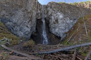
Fairy Falls

Fairy Falls

The hike to Fairy Falls is a pretty easy 4.5 km walk, very flat, through the newly grown forest after the fire of 1988.  Along much of the trail there is a thick growth of new lodgepole pine.  Towering above are some old burned snags, very few still standing, but heavily charred spires sticking high into the sky.  It was the first really nice sunny day we’ve had since the day we went to Old Faithful.

The first mile of the hike is along the east side of the Midway Geyser Basin, and the springs were very foggy in the cool morning air.  The fog above Grand Prismatic Spring was pastel colors of pink, blue and green.  A large bison bull stood just off the edge of the trail drinking from the hot pool water.

Fairy Falls is quite tall, about 200 feet high, and though there is not much water flowing over it, it is one straight drop into a pool below a cliff.  Some of the water strikes the cliff about half way down, and then forms a lace background to the water that falls straight down.

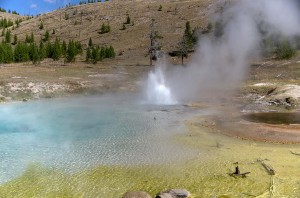
Imperial Geyser

Imperial Geyser

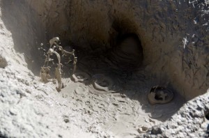
After the falls we continued on for another kilometer to Imperial Geyser.  This was quite impressive, spouting almost continuously, then stopping for a few seconds suddenly, and then starting up again.  It sometimes threw water thirty feet into the air.  It was very quiet, with just the noise of the geyser, and the mudpots bubbling not far away.  Enid jumped and I was startled when someone came up behind us suddenly.  I said to the man, “at least you weren’t a big bear!”  Shortly after this a few more people came by, but none of them stayed as long as we did.

Mudpots

Mudpots at Imperial Geyser

We were among the first out on the trail this morning, but when we returned we met many more people.  The parking lot was jammed, and there was barely room to get the Tahoe out between the parked cars and incoming traffic.  Not many of the people in the parking lot were on the trail to Fairy Falls, mostly just following along the trail by the hot springs, but some of them were climbing up to the high hill on the west of the springs.  You could probably get a really good view from the top.

After we returned we drove to Whiskey Flats picnic ground, where I found a good sized dry log which we loaded in the back of the Tahoe.  After that we drove around the Firehole Lake Road, and stopped at the lake to watch the hot rapids.  Tonight when we got back I sawed and split wood so we will have a fire tonight, and enough wood for at least two more campfires.

Posted in Going South, 2013 | Comments Off on Fairy Falls, September 16

A Zoo Without Fences, September 15

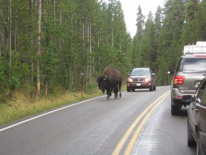
Bison causing traffic jam in Yellowstone Park

Bison causing traffic jam in Yellowstone Park

Today we travelled to the far northwest corner of the park, to Mammoth Hot Springs, to see the beautiful travertine deposits there.  However, we got there by going around the east side of the grand circle route which took us along the Yellowstone River and the Hayden Valley, before crossing over to the Norris region.

Along the river we saw many animals, large herds of bison, trumpeter swans, and a wolf pack (admittedly far away, almost a mile but visible through binoculars).

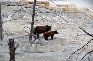
Bears at Canary Spring

Bears at Canary Spring

But the best bear sighting by far was at Mammoth Hot Springs.  As we came to the end of the Canary Spring boardwalk a small very black bear cub was walking quickly through the bush.  It followed up along the boardwalk for a way, then disappeared into the bush.  Shortly after a brown mother bear with a brown cub showed up and sat on the edge of the travertine.  The cub was making a loud grunting sound, and later its mother grunted as well.  I filmed them there, though it wasn’t the greatest location as there were many trees in the way.  We started walking back, though there were many, many people crowded into the end of the boardwalk trail watching the bears.  About 25 yards back on the boardwalk, I stopped, and set up the camera and tripod, and the pair of bears walked directly towards us.  They circled around a bit, looking like bears in snow on the white travertine, and since all the other people were still down at the end of the boardwalk, got some very nice pictures.

We left, drove the circle loop around the rest of upper terrace, and as we came down on the highway saw that the bears, now joined by the black cub, were walking directly down the hill towards the lower boardwalk trail.  A huge crowd of people were taking pictures of the bears along the trail.  We saw one man who was talking on his cellphone, without looking up, and walking directly towards the bears.  We guessed that he was going to get a good surprise!


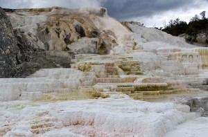
Artists Palette terraces

Artists Palette terraces

We parked at the bottom of the hill, and then started walking up the trail.  We first went to the Artist’s Palette terrace, which is one of the most spectacular there.  Then we walked up towards the higher boardwalk, and saw a ranger with a radio.  There was a large crowd of people following the bear along the top boardwalk of the terraces, and another ranger up there doing crowd control.  The bears disappeared over the top of the hill, and the crowd dispersed.  Not long after that we heard shots and saw gunsmoke at the edge of the trees, so we assume that the rangers were trying to frighten the bears from the area.  It wasn’t the best place with several hundred tourists trying to take pictures of them up close!

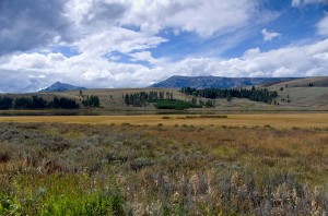
Swan Lake in Gardner's Hole

Swan Lake in Gardner’s Hole

On the way back tonight we saw a grizzly bear on the shores of Swan Lake.  Had there not been a man there with a spotting scope trained on the grizzly, we’d never have located it, even with binoculars, as it was low down and lying in the grass right at the water’s edge.  Since I showed the man with the scope where a bald eagle was perched in a tree above the bear, he was happy.


Posted in Going South, 2013 | Comments Off on A Zoo Without Fences, September 15

A Rainy Day, September 14

We thought we might go to Mammoth Hot Springs and
drove a few miles before we decided the weather wasn’t worth the
trip.   We turned around and came back to do our laundry.
Unfortunately the weather doesn’t look very good for a few days.  There is rain in the forecast until Tuesday.  I’m using the down time to edit all the hot springs video I took yesterday.

Posted in Going South, 2013 | Comments Off on A Rainy Day, September 14

Old Faithful Geyser Basin, September 13

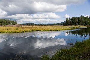
Firehole River at Biscuit Basin

It didn’t rain over night, but was still cloudy this morning, though it didn’t look as heavy as yesterday.  As we drove towards Old Faithful the clouds were low so we drove through fog, but as we came off the continental divide the clouds lifted, and the sky was quite sunny.

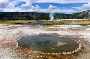
We got to the visitor center just after the eruption of Old Faithful was finished.  We were planning to see Grand Geyser, but we had a couple of hours, and we didn’t want to hang around for 90 minutes to see Old Faithful, so we walked through the geyser basin, taking many pictures and video.  When we got to the Morning Glory Pool, we decided not to go back to Grand Geyser, but instead to continue on the trail towards Artemisia Geyser, which we hadn’t seen before.

Along the Artimisia Trail

Along the Artimisia Trail

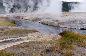
It was amazing that once past the end of the boardwalk trail the crowd immediately was gone.  We saw only a couple of others along the whole trail north for a couple of kilometers.  There were no big geysers, but many hot springs, and since there was no boardwalk, you could walk up quite close to the edge — within reason of course as they are full of boiling water!  It was a much more pleasant experience than the huge crowds around Old Faithful.

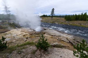
We crossed the highway to the Biscuit Basin and ate lunch.  Then we walked around the Biscuit Basin, which doesn’t have very spectacular hot springs or geysers.  One geyser did erupt about every ten minutes, and just as we got there, it stopped.  We walked about halfway around the boardwalk, and it started again, so we started walking back towards it.  You could tell it was going to stop soon, so we turned back, finished the boardwalk, and waited for it.  It erupted for a couple of minutes, but the steam was blowing towards me so badly that I doubt if I got any good video of it.

Gem Pool

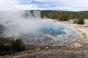
We walked back along the Artemisia trail, and found a couple of mud pot hot springs that were really boiling.  As I turned to go between them, my foot caught in a small hole (or I may have broken the crust) and I stumbled, but regained my footing.  You  wouldn’t want to fall into the boiling water!

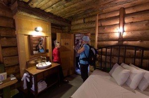
A room in the Old Faithful Inn

A room in the Old Faithful Inn

Old Faithful was just erupting as we got to the Old Faithful Inn.  We decided to go into the Inn, and a tour was just starting as we walked into the lobby, so we joined it.  The tour guide told us a good deal about the history of the Inn, how it was constructed, and its architectural features.  We went into one of the rooms, which are very small, and cost over $100 per night — no shower or bathroom either, they were down the hall!  It makes our $15 per night for our trailer campsite seem rather reasonable.

It started to sprinkle rain just as we walked out of the visitor center to go home.  We were lucky, as the forecast was for rain, and we ended up having a very nice mostly sunny day.

Posted in Going South, 2013 | Comments Off on Old Faithful Geyser Basin, September 13

Gas Troubles, September 12

Firehole River

Firehole River

It started to rain just as we awoke this morning.  However, it didn’t look too bad, and there were some patches of blue sky, so we decided to go view some of the hot springs, mostly planning to stay in the car and just drive from site to site, getting out to see a bit of the geysers and steam.  We’d got part way to the Old Faithful area when we realized that we hadn’t turned off our furnace, but didn’t think it would be a problem as it was turned down so low.

We went to a couple of geyser basins (Black Sand, and Midway), but then it started to rain more heavily as we drove around Firehole Lake drive, so we gave up and came back to the campsite.

As I approached the trailer I could hear a piercing beep, and when I opened the door heard that the furnace was on, and the propane detector alarm was activated and flashing a red light, as well as it’s siren being on.  I assumed it was a problem with the furnace, especially as the bathroom door was open and blocking the furnace vent, so I shut off the furnace, and opened all the windows.

That silenced the alarm, but it went off again as soon as I opened the doors under the kitchen sink.  With all the windows open, the alarm was silent, though it still smelled of propane in the trailer, as we ate our lunch.

After lunch we checked for leaks with soapy water, but found nothing.  Within a minute of closing the windows the alarm would come back on.  We shut down everything that uses gas (the furnace, the water heater, and the refrigerator) and that made no difference, so we went outside and shut down the main gas valve, and were on our way to the service station to see if they had a propane technician.

Then I remembered that I had hit the barbecue propane tank this morning when I was putting away the electric cord,.  Since it is in storage under the front of the trailer, I opened the door, and the odor of gas was very strong.  Sure enough, the main valve on the tank was open half a turn.

We opened all the storage compartments, and aired out the inside of the trailer, and it seems to now be ok.  It has been over half an hour with things running and the windows closed, and everything seems ok, though the odor lingers as it has probably permeated everything organic in the trailer.

Posted in Going South, 2013 | Comments Off on Gas Troubles, September 12

Ousel Falls, September 11

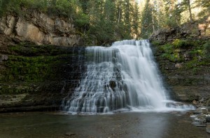
Ousel Falls

Ousel Falls

It was not as cold last night, though when we drove in to Big Sky this morning to go for our hike just about 8 am, it was cold enough that there was a lot of mist over the Gallatin River.  We wanted to take the hike in to Ousel Falls, which is supposed to be an easy hike (and was, though it did go up and down quite a lot).  However, we missed the turn into the parking area and drove much farther than we needed to.  We first followed the main road, but it was obviously going in the wrong direction so we headed back, took Ousel Falls Road, which soon split off into Ousel Falls View Road, which we took.  That didn’t look correct, so we backtracked, continued high up on Ousel Falls Road, and soon came to a dead end.   We turned around once more, and saw that we had gone too far at the very first turn, and eventually located the falls hike parking lot.

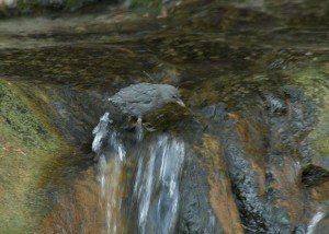
Ouesel (Dipper)

Ouesel (Dipper)

From there we set off on a very well maintained trail.  Not far down the trail was a sign saying “No Cross Country Skiing” and it was soon obvious why.  The trail took hard switchback turns going down, and there was a sheer and unprotected drop-off over the side at the turns.  If you didn’t make the turn, you’d be dead!  We continued to drop down until we came to a bridge across the river.  The river is obviously one of many branches that make up the Gallatin River, as it was labelled “South Fork of the West Fork of the Gallatin River”.

After climbing out of the river valley again we reached the falls, not long after passing a small falls called the South Fork Cascades.  Ousel Falls are a very pretty falls.  At this time of year they are not flowing very fast, so that it was easy to go to the base of the falls.  At high water levels this would probably not be very easy.  We then climbed to the top of the falls, and saw the bird for which the falls are named, an Ousel, or Water Dipper.

Gallatin River, along Highway 191

Gallatin River, along Highway 191

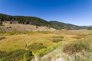
We returned to our campsite and packed up the trailer, then ate lunch.  We left the campsite very close to noon, and drove to the town of West Yellowstone.  The road follows the Gallatin River and it was a very scenic drive.  The fall colors are just starting so the shrubs along the river were starting to turn yellow.  We saw many fishermen along the way.

We got gas in West Yellowstone (the most expensive gas we’ve bought so far in the US) then travelled along the Madison River into the park.  This is a part of the park that we haven’t seen before, and here too we saw many fishermen in the Madison River.  The road crews were working setting up the snowplow flags along the side of the road, so that is exactly as it was last year when we were here.  The roads were not too busy, but I did see on a sign near the entrance that almost all the campgrounds are full.

After we checked in to Grant Village Campground we went to the park office to ask about the best places to hike.  The woman at the desk said, “well that’s a matter of opinion,” so I said to her,”Well I respect your opinion.”  She then did tell us about five hikes that she thought were good.  We hope to do more hiking here this year, since we have seen all the geyser sites.  We do plan to go back to some of the better ones of those too.

Posted in Going South, 2013 | Comments Off on Ousel Falls, September 11