Beehive Basin Trail, September 10

image

Beehive Basin

It was definitely cold last night.  There was frost on the windshield this morning.  Fall has arrived here in the mountains of Montana.

We drove to Big Sky after breakfast and stopped at the tourist information office where we got some information and maps about the hikes in the area.  We decided to do the Beehive Basin hike, since it was about the right distance.  To reach the trailhead you drive for 9 miles west of Big Sky towards the ski resort area.  The valley is dotted with expensive looking chalets and houses (many of which are for sale if you have a few extra million dollars).  There are many, many ski runs visible on the mountain.  But it is definitely off season, as nothing appeared to be very busy.

image

Butterflies on asters

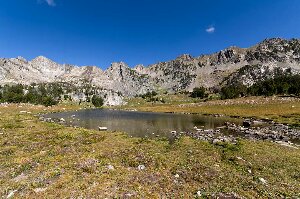
The trail turned out to be almost exactly 5 km long to the top and an elevation gain of 450 m.  The elevation gain is spread over much of the distance, so it was never extremely steep.  The steepest part is the last 1.5 km, about the part that is inside the Lee Metcalf wilderness area.  The first part of the hike is abutted by private land, and there were some nice “cabins” visible on the hills beside the trail.  The last 500 m is definitely the steepest, and then the trail opens out into a wide basin with a very small and pretty lake, framed by the backdrop of rugged mountains.  The trail is in very good condition, and surrounded by very lovely views.  Though there were not many flowers still blooming, we did find on the way back, a few late asters that were covered with butterflies.  All around the meadows were covered with seed pods, so it must have been very spectacular in the early summer.

The fisheries department are trying to kill off the non-native trout in the lake.  They have set several gill nets in the lake.  We spoke to one of the men working on this project.  He said they estimated there were about 200 fish in the lake, and they have so far netted 42.  They want to get the population down to a level where it can no longer reproduce, and then they may re-introduce the native cut-throat trout to the lake. 

There were quite a few people that made the hike today.  The weather was beautiful, sunny, and a very nice temperature to walk.  We ate our lunch at the top in the basin, surrounded on three sides by high mountain cliffs.  It was a lovely spot.

Posted in Going South, 2013 | Comments Off on Beehive Basin Trail, September 10

Red Cliff Campground, September 9

image

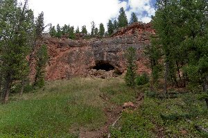
Red Cliff and cave

There was a very pretty sunrise this morning.  The only other campers in the campground were also up early this morning, and they were taking pictures of the sunrise over the lake.  We left at 7:30 am, drove through Helena without stopping and bought gas in the small town of Townsend.  We noticed what seems to be a nice forestry service campground along the Missouri River, right on the outskirts of Townsend, and thought it might be a nice place to stay in the future.

We got to Bozeman about 9:30, and first went to McDonald’s to use the wifi (and get a cup of coffee).  After catching up on emails, we went to the REI store, where we bought some clothes, and I got a new pair of hiking shoes.  They had an interesting wood burning stove there, which uses heat from the fire to generate electricity, charge the battery which runs a fan, and also can be used to charge USB devices.  I was tempted to buy one, but after reading several reviews on the Internet decided against it.  It does seem like a neat idea, but apparently you have to keep stoking it up with wood constantly, which doesn’t work so well when you are cooking on it.

There is a fair amount of construction taking place on Highway 191 south of Bozeman.  We had to wait for pilot cars twice so it took us some extra time to get to our campsite here at Red Cliff.  We weren’t sure where the site was, and the directions we had didn’t mention that it is just south of the town of Big Sky.  If we’d known that we’d have been a lot more confident we were heading in the right direction.  We did find the site, and it’s clearly marked with a highway sign.  As we learned later tonight from the campground hosts it also has a newly constructed left turn lane.

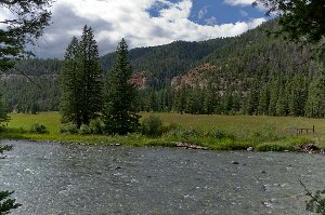
We hiked for a couple of hours south along the river.  It is obvious why this is called Red Cliff campground, as right where the trail starts is a high red cliff with a large cave.  The trail that leaves from the end of the campground eventually joins with trail 165, which is marked on my topographical maps.  We didn’t have time to go to the end of the trail, which runs for several miles back into the mountains, but did follow it for a few kilometres.  At first the trail follows the river, then it goes up a switchback for a while (we were worried that it was just going to be a steep hike up the hill), but it soon flattens out, and was a nice pleasant hike through some large trees.  We saw a lot of wolf scat with lots of hair in it along the trail.

image

Gallatin River

There are a lot of very large old trees in this campground.  Many of the trees here have one or two plastic “buttons” in a strip of plastic about 2 inches by 4 inches long nailed to them.  It is some type of insecticide that is being applied to the trees to minimize the effect of parasites (pine beetles?). 

Posted in Going South, 2013 | Comments Off on Red Cliff Campground, September 9

White Sandy Campground, Helena, MT, September 9

image

Hauser Lake

We got away in good time this morning and drove to Milk River where we checked our email.  From there it is just a short drive to the border crossing where everything went very smoothly.

After crossing the border we drove to Shelby, MT and got gas, then continued on to Great Falls.  We stopped there to buy a good supply of groceries, stocking up for about the next ten days.

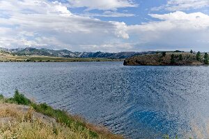
After Great Falls we drove to just north of Helena, MT.  The White Sandy campground is a forest service campground, but very nice.  It is on the shore of Hauser Lake, a reservoir on the Missouri River.  When we got here there was a small notice posted on the registration board that the campsite is closed from today until September 20.  There is no-one else in the campground, but the ranger said we could stay here for one night.  They are closing the campground to seal coat the roads.  The roads are in very good shape though, so there can’t be a lot of work to do.

I washed the front bumper of the Tahoe, and the front of the trailer this afternoon.  They were very badly covered with grasshoppers.

We drove through quite a bit of light rain today.  It was also very windy this afternoon.  It threw the trailer around a great deal, since it was mostly a cross-wind.  It hasn’t died a great deal yet this evening, and since it is a north west wind, it’s quite a bit cooler.

Unfortunately there is no T-Mobile coverage in this area, so our Roam Mobility cell phone doesn’t do us any good.  We will have to stop somewhere to get wireless access to post this.  We are not likely to have any coverage in Yellowstone at all.

Posted in Going South, 2013 | Comments Off on White Sandy Campground, Helena, MT, September 9

Writing-on-Stone Provincial Park, September 7

image

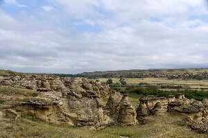
Hoodoos along the Milk River

It began to rain last night, and it poured heavily for at least an hour.  It was just about the time most people were starting to build campfires for the evening, so the campsite quieted down very quickly.  It then rained off and on, but ended sometime before morning.  It was cloudy dull but dry as we packed up and drove towards Taber.

After fueling at Taber we tried to contact this park, but the office wasn’t open on Saturday.  We drove on to Milk River where there is a large Travel Alberta site (designed to capture Americans as they cross the border).  The young female clerk didn’t have any more luck than us, though she tried to get information about the park by Internet and phone.  The only real concern was that the park website showed the campground full.  We didn’t think that was credible at this time of year, and that it was just a reflection of the fact that the campground is not reservable after the September long weekend.

It turns out that our assumption was correct, for the park was fairly empty when we arrived here shortly after 12:30 (now this evening it isn’t more than half full).  I had some difficulty getting the trailer into the campsite, so drove around the loop a second time to change the angle at which I was approaching it, and had success on my second try.

After the trailer was set up we went for a hike along the Hoodoo trail.  We had picked up some brochures about the trail and the rock art from the campground host; however, we had a bit of trouble locating where the trail actually started.  Once we got our bearings, we followed the trail, which climbs up and down through the hoodoos, along the bank of the river.  At times the trail is steep and goes through narrow openings between the rocks, just wide enough to get through with a backpack on.  Many of the steepest parts have steps cut into the sandstone, and at one of them there was a handrail.

image

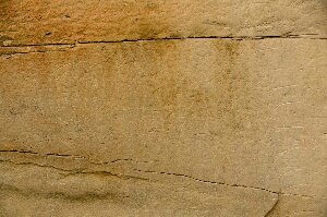
The battle scene

The hoodoos themselves would be a very pretty hike, but there are also a few places along the trail where you can see petroglyphs and pictographs.  At the first of these sites there are a few carvings in the sandstone about 10 feet from the ground (if there were lower carvings they would likely have been obliterated by modern graffiti artists scratching their names overtop).  The most impressive site though is the “Battle Scene” which is a very large drawing with many, many pictographs of a First Nations battle between two or more warring tribes, sometime around 1866.  The drawing shows a large number of men with guns, two camps with teepees, and two opposing forces shooting at each other.

Past this part the trail climbs up a long sloping hill to a viewpoint that overlooks the Milk River Valley and the old site of a NWMP post.  The post was set up in 1887 (on a site where the Mounties had originally arrived in 1874), and used as a border patrol post along “Police Coulee” which runs southwards and crosses over into Montana.   The post was finally abandoned in 1918.

After supper this evening we walked to the beach area on the Milk River which is very close to our campsite.  They must have a lot of trouble with beaver here, for the entire campsite is fenced, and signs along the fence remind you to close the gates to keep the beavers out of the park.

Posted in Going South, 2013 | Comments Off on Writing-on-Stone Provincial Park, September 7

Coulee View Trail, September 6

image

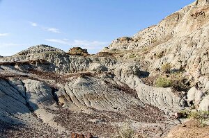
It didn’t rain overnight, so we hiked the Coulee View trail, which starts from the visitor centre, this morning.  First though we registered for the bus tour of the restricted part of the park for this afternoon.  It was a good thing that it hasn’t rained, for the clay of the coulee would be impossible if it was wet.  At several of the steeper spots they’ve put up stairs, sometimes metal grates, but the clay would still be incredibly slippery on the steep slopes.  It was much cooler as well this morning, so it was a nice hike.

image

I’d taken the cell phone with me, and at the top of the hills it received signal.  We were able to read and respond to a couple of emails.  I will probably hike back there tonight so that I can post this blog.

After we came down from this trail we hiked from our campsite to the Cottonwood Trail.  This is a very flat hike that forms a circle loop near the Red Deer River.  Some of the ancient cottonwoods are massive, several feet in diameter, and they are estimated to be over 200 years old.  They don’t grow very tall though, as they wouldn’t be more than 20 feet high.

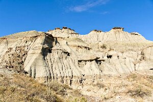
At a little after 1:00 we headed up to the museum at the visitor centre which has we visited until we boarded the bus at 3:00 for the Explorers bus tour.   The bus tour wasn’t as good as I’d hoped as we had little time off the bus to view the scenery. At the four stops we did have, we spent much of the time listening to talks about the explorers, most of it information we already knew.  The third stop was good though as they have an almost intact skeleton of a duck billed dinosaur. The next stop was also good as it featured some spectacular hoodoos.

It has gotten much cooler this afternoon and a lot of cloud has rolled in. We were worried that it was going to rain as we left the roof vents open in the trailer. Fortunately it has not started yet, but it is much cooler than this morning and quite windy.

Posted in Going South, 2013 | Comments Off on Coulee View Trail, September 6

Dinosaur Provincial Park, September 5

image

Yesterday we left Prince Albert shortly before noon, drove to Eston (which we reached around 3:30) and visited with Enid’s mother.  We took her from the Jubilee Lodge to where we had set up our trailer, and had a nice barbeque for supper.  Duane also came in, taking off some time from preparing for harvest, and we had a good visit on a beautiful evening.

This morning we stopped back at the lodge to visit for a bit, then left at very nearly 9 am.  We headed west on highway 44, which got considerably worse as we got closer to the Alberta border.  The GPS wanted to take us down highway 21, but we didn’t want to go that way, as we planned to join up with Alberta Highway 554.  That road is in very good condition, so once we reached it, travel was a lot easier.  One thing you need to be careful of on this route is to make sure you have enough fuel.  There is none between Eatonia, SK and Jenner, AB, a distance of about km.
We got to Dinosaur Provincial Park at about 1:00 pm.

As we left the highway we were worried since the park sign said the campground was full.  However, I’d checked on the Internet last night and it looked like there were many sites available.  That turned out to be the case, and they simply haven’t changed the sign since the long weekend.

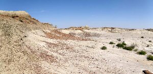
After setting up the trailer we went back to the information centre.  There we got a brochure describing the short (3km) scenic drive and the hikes that depart from it.  You can’t go into much of the park without an accompanying guide, and we had missed the only guided hike today (it was departing just as we arrived).  We did hike around the badlands trails and enjoyed the scenery.  There are also two places where they have erected shelter buildings over the remains of dinosaurs that are still in the ground, so we saw those old bones.

It was very warm today.  The temperature was well over 30 C, probably close to 35.  There was a light breeze, but it felt very warm while walking in the dry heat of the badlands.  Tonight it has cooled off some, and there is a large threatening thundercloud building to the west.  The forecast is for rain showers.  If it does, we won’t be doing much hiking tomorrow on the slippery bentonite clay of the badlands.

Posted in Going South, 2013 | Comments Off on Dinosaur Provincial Park, September 5

Kinowa Lake Trail, June 5

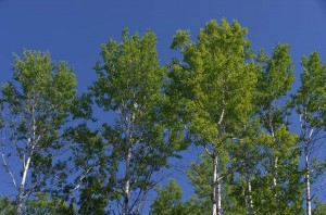
Trembling aspen

Trembling aspen

We hiked the approximatey 10 km return trip to Anglin Lake on the Kinowa trail on our last morning in Prince Albert National Park.  It was a nice morning to walk with a strong breeze (if we were out paddling we’d call it a wind, but we were sheltered in the trees).

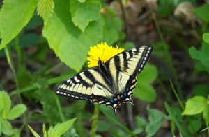
Swallowtail butterfly

Swallowtail butterfly

There were hundreds of dragonflies at Anglin Lake.  There were also a lot of swallowtail butterflies.  The butterflies are hard to photograph as they don’t sit still for long.

After lunch we headed back in to Prince Albert, where we have a lot of unpacking and cleaning to do.

Posted in Summer, 2013 | Comments Off on Kinowa Lake Trail, June 5

Wolves on Shady Lake, June 4

image

Beartrap Creek

Today was a day when we saw a lot of wildlife. I awoke early this morning so that I could try to take pictures of birds. I did get find some merganser ducks but didn’t get too many pictures before my camera locked up on me again. It seems to be doing it more and more, possibly when it is cool.

We drove north to the Narrows road where we planned to launch the canoe at Beartrap Creek and paddle to Shady Lake. Along the road we saw at least six deer and one black bear with a cub.  The cub ran into the bush right away but the mother stayed and ate dandelions in the ditch. Of course my camera didn’t work again, but we did get pictures of the bear on Enid’s.

A large beaver swam by as we prepared to launch our canoe in Amiskowan Lake.  It was carrying a stick in its mouth and swimming to where it was building a dam where the road bridges the stream.   The beaver seemed unconcerned about us as it swam back to its lodge right by the road.

Amiskowan Lake isn’t much more than a widening of Beartrap Creek and much of it is quite shallow, just deep enough for the canoe to pass over deep beds of vegetation that will soon be blooming. Beartrap Creek itself is narrow, winding, and shallow where it meanders to join Amiskowan and Shady Lakes. It was just navigable depth and Enid had to do a lot of drawing from the bow to get us around the tight turns and stay in the deepest water.  We only had to get out of the canoe once going upstream at a very shallow rocky riffle.

There us a small dock and a canoe on shore where the creek exits Shady Lake. There are some park buildings and work residence trailers back in the bush here, and what looked like a red truck (this turned out to be a helicopter as it flew over us just after lunch).

I heard what I thought was a wolf howl soon after we’d entered the lake.  Almost right away many howls joined in, but they sounded like pups rather than mature wolves. We paddled slowly along the shore hoping to see them and caught sight of a female wolf with swollen teats hanging below her belly. She was just back in the bush a few feet from shore and seemed to be following us. We got a good view of her at a very small opening in the shoreline vegetation and then she scrambled up the bank.

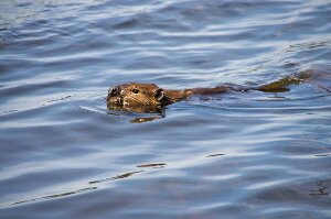
We paddled around the lake, stopping for a few minutes where the Shady Lake trail with its boardwalk steps drops down almost 200 metres from the highway. There are some huge spruce and birch here, as well as a small beaver lodge (we used the lodge to more easily beach the canoe).  A beaver came out and swam around while we watched it from shore before we paddled on to the end of the lake.

image

Beaver on Shady Lake

We went up Beartrap Creek for a short way. It was navigable as far as we went upstream, but the creek is not very large. Since it was time for lunch we went back across the lake to a grassy spot just north of steps at the end of the Shady Lake trail. After lunch I took a lot of pictures and video of two beaver swimming out side their lodge. Finally they got the courage to enter it and I could hear them sniffling and breathing inside it.

We took off our shoes and waded at the two shallowest places on the way back down the creek going back to Amiskowan Lake. The water was a nice temperature as it flowed over the mostly sandy bottom.

We saw another bear by the highway as we drove back to our campsite but the highlight of the wildlife we saw today was the female wolf.

Posted in Summer, 2013 | Comments Off on Wolves on Shady Lake, June 4

Loons on Sandy Lake, June 2

image

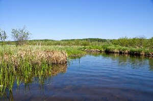
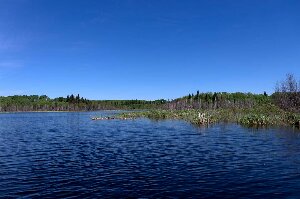
Marsh at the west end of Sandy Lake


It was another nice though cool morning as we took the canoe across to the far side of Sandy Lake.  The wind was from the east so it was behind us and with the long open sweep of the lake built to become quite strong by the time we were on the west shore. It was nice in the sheltered marsh and I tried to photograph some of the ducks.   I didn’t have much luck with ducks as they flew away before we could get close but I did get some good photographs of both male and female red-winged blackbirds.

Just as we were about to leave and so I was putting my telephoto lens away, a number of otter stuck their heads up out of the water not far away. Unfortunately they were gone by the time I got the lens remounted.  Though we could hear them snorting in the weeds, we couldn’t see them again.

We stopped at the island to eat lunch and to wait and see if the wind would die, since there were now whitecaps on the lake. Just as we were finishing lunch we heard a loud slap of a beaver right in front of us.   Shortly after the beaver appeared and swam back and forth as if it wanted to come ashore. It swam to just a few feet from us but then finally swam away.

image

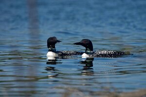
Loons

By now I had the camera set up so got a couple of pictures of the beaver. There was also a loon which we could see just around the corner behind some brush. Finally it swam in front of me so I could get its picture. A second loon joined it and the two swam back and forth diving just off shore and calling to other loons out across the lake

We stayed on the island for almost two hours while I took a lot of pictures, then we started back. It was quite rough at first as we headed straight into the wind and the white caps. We cut across to the northeast shore to try and avoid the wind.  It may have helped some, though by now the wind seemed to have decreased, at least some of the time, though we still got some strong headwind gusts.

Not long after we got back to shore a young man who was backpacking stopped very close to our campsite and set his pack down.   A few minutes later he asked if the water in the lake was safe to drink and we told him, “yes,” but that it needed to be boiled or filtered. Since his accent showed that he was clearly not local we struck up a conversation with him, learned that he was from Germany here in Canada for about three months of hiking and wilderness travel.  He had hiked across to the west side of the park and back and was planning on hitch hiking a ride into Waskesiu later on today.

We found that he had met several people we know here and in Waskesiu. After a couple of hours visiting and sharing experiences with him we offered him a ride into the town. Daniel W–, who had just finished his first degree, couldn’t understand why the park was so undeveloped and the hiking trails so underutilized.  I think he found it amazing when we told him how few people live in this area. We shared a lot of common interest though in wilderness and it’s beauty and solitude.

After driving to Waskesiu and back we built up a campfire in our neighbor’s (who left earlier this afternoon) firepit, and roasted sausages for supper. Enid took advantage of the fire to also roast some marshmallows, so now we really have been camping!

Posted in Summer, 2013 | Comments Off on Loons on Sandy Lake, June 2

Spruce River Highlands Trail, June 1

image

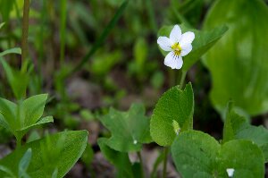
White Violet


We hiked the many hills of the Spruce River Highlands Trail this morning. It was slightly overcast and a bit cooler than it has been, but a nice morning.  Not far from the start of the trail we came suddenly upon a whitetail doe.   She was not very frightened of us and walked along the trail ahead for a ways before walking into the bush.

image

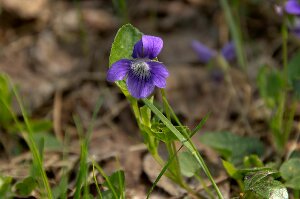
Purple Violet

There were many flowers, mostly violets both purple and white, as well as a number of other flowers that I will have to use my reference books to identify. The trail isn’t really long, just over 9 km, but the number of steep hills make it the most difficult hike in this part of the park.

This evening I paddled the kayak to the far end of the lake.   It was very calm but quite cool.  A couple of very large beaver swam around the kayak slapping their tails. I also saw a deer run up the hill as I approached.

The lake is high and has been for several years. Because of this the shoreline is strewn with many dead trees, especially a lot of birch.

Posted in Summer, 2013 | Comments Off on Spruce River Highlands Trail, June 1