Shutdown, but not out, October 1


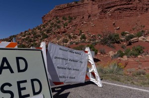
Closure sign at Natural Bridges National Monument

Closure sign at Natural Bridges National Monument

Well, the US government can’t get it’s act together, so all the National Parks and lands are shut down.  After a bit of thought this morning, we decided to return home to Canada, since 90% of what we are doing here in the Southern US involves national parks and monuments.  Without knowing when they may reopen, we just don’t have enough options to make it worth our while to stay here.  So, tomorrow we will head back.

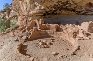
Five Kiva Pueblo

Five Kiva Pueblo

We did though really enjoy our last day of tourism.  In the morning we drove to the Westwater Canyon, which is just outside of the town of Blanding, Utah.  There we found the Five Kiva Pueblo at the end of Ruins Road.  I scrambled down the canyon and up to the pueblo on the far side, but Enid did not.  On the way back I found a better trail than the one I used to go in, so it was much easier to get back.  However at one point I lost this trail too, and started climbing up some old footholds carved into the cliff.  It was very hard to do while carrying a tripod, I was afraid I would fall, so I abandoned that route and managed to locate the trail once more.  Then it was an easy hike.

A bit closer to town is a sign saying National Natural Arch, and a hiking symbol.  We looked for a trail, and at first found nothing, then hit a well defined trail, but it only lasted for a short distance and disappeared.  We walked through the open brush for a way, but decided it wasn’t worth while, so quit.

We then drove towards the Natural Bridges National Monument (which we assumed was closed, but we thought we would check if it was for sure).  Along the way we stopped at the Mule Canyon Pueblo which is a restored site from one thousand years ago.  When we did get to the park we found that it was closed.  Four French people were there at the sign, not sure what was going on, and wondering what to do.  They spoke very poor English, but better than our French, and I think they understood us as we explained to them that the government has shut down because of a funding controversy.  We felt badly for them, as they have travelled here for about two weeks to see this beautiful part of Utah, and it is effectively closed.  We marvelled at the stupidity of a government that cannot govern.

We drove to the Kane BLM Ranger station.  It too was closed, but we ate our lunch on a picnic table there.  Several other couples came by, one in particular from Tennessee, and we spoke to them.  They suggested that we might want to go to Monument Valley, as it is Navajo run, so they thought it would be open.  That became our plan.

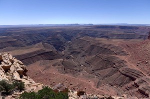
Mulie Point overlook over the San Juan River

Mulie Point overlook over the San Juan River

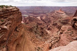
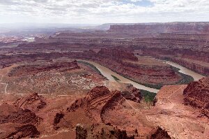
However, when we got to the Moki Dugway, a very short steep section of gravel road that drops over 1100 feet in 3 miles from the top of Cedar Mesa to the valley floor, with very sharp switchbacks, we saw a sign that said “Muley Point”.  We thought that this was the name of the viewpoint straight ahead of us which we walked out to, and took pictures at.  A truck from Missouri had stopped there as well.  But, as we were coming back to our vehicle, a small SUV came down the road and said it was well worth it to drive to Muley Point.  We realized then that we were not where we thought, so took the dirt drive, about 3 or 4 miles, to the point, which had fantastic views out over the meanders of the San Juan river over a thousand feet below.

While there we spoke to the couple from Missouri again, and they recommended that we go to “The Valley of the Gods” instead of Monument Valley.  They thought that the latter might be closed, as while it is run by the Navajo, it is a US National monument.  So that is what we decided to do.

On the way down the Moki Dugway (actually a mining road from the 1950’s when Uranium was  mined on top of the mesa), which is pretty narrow, just barely wide enough for two vehicles to meet, there is a viewpoint pullout near the top.  We stopped here to take pictures, and a woman carrying an armful of necklaces came and talked to Enid.  Enid looked at them, but didn’t offer to buy anything.  As we were about to leave, I suggested to Enid that the price was really reasonable, and so she bought a turquoise pendant.  The woman selling it told us that she was Dine, and so we told her that we also have Dene in Saskatchewan, and we had a short conversation about that.

At the bottom of the dugway  there is an immediate left turn to the Valley of the Gods, but no sign coming down the hill.  As we passed the sign on the other side of the road, we looked back, and realized that we’d missed the turn, so found a spot where the road was flat enough in the ditch that we could turn around.  It looked like many others had used the same spot for the same reason.

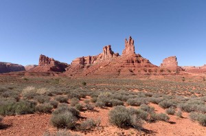
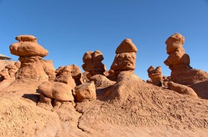
Buttes in the Valley of the Gods

Buttes in the Valley of the Gods

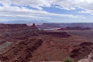
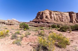
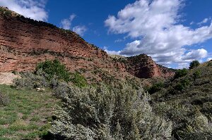
The recent heavy rains have caused all the washes to be quite rough.  We were glad we were driving in a vehicle with high clearance and good suspension.  We met a lot of smaller vehicles that I wouldn’t want to drive on this road.  Perhaps they were rental cars, for as we learned in Hawaii, a rental car is better than a four wheel drive, for a rental car can go anywhere!  We were glad that we made the drive, which took us a couple of hours (to go about 17 miles) as there are many large monoliths and buttes in the valley of spectacular red rock.  So although nothing official was open, we very much enjoyed our day of driving through some spectacular Utah scenery.

Posted in Going South, 2013 | Comments Off on Shutdown, but not out, October 1

Blanding, Utah, September 30

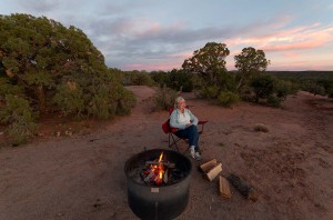
Evening in Horsethief Campground

Evening in Horsethief Campground

Yesterday was not much of a tourist day.  We did laundry, I had two conference calls to make for the National Officials Committee, and then we bought groceries before heading back for our last night at Horsethief Campground, and a wiener roast.

Today we stopped in Moab on our way through and I updated the Verizon USB modem so that I have enough data on it for the next month.  I am really not pleased with the Roam Mobility (T-Mobile) that I have on the phone.  There is little T-Mobile coverage in the areas we are travelling, and the data really is very, very slow.  We won’t be renewing it when the coverage expires at the end of this week.

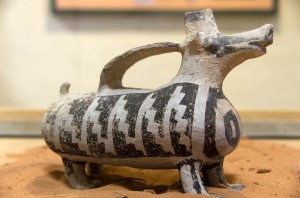
Anasazi pottery

Anasazi pottery

After that we drove south for about an hour to Blanding.  When we checked in to the Blue Mountain RV park they showed us some pictures of the Anasazi ruins here.  We knew about the Edge of the Cedars State Park museum, but not the other sites.  First we did tour the museum, then we went to the visitor center to see if we could get directions to the other sites.  The lady in the information office gave us a couple of area maps, but they weren’t very specific about directions.

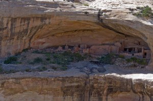
Butler Wash ruins

Butler Wash ruins

We drove until we eventually found the Butler Wash ruins site (which is clearly marked off highway 95).  It is a short walk of about 800 m in to an overlook over a canyon.  There are several pueblo buildings in the caves of the cliffs.

The woman at the information office told us that the National Parks would likely be closed tomorrow, since the US government is shutting down because of the Republican refusal to accept Obamacare.  It doesn’t sound very promising for us to go to Natural Bridges tomorrow, which was really the reason we came to Blanding.  We aren’t sure what we will do now.  Almost all of our plans over the next couple of weeks involve touring in US national parks, so if they are closed we will have to reconsider our options.

Posted in Going South, 2013 | Comments Off on Blanding, Utah, September 30

Islands in the Sky, September 28

image

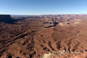
Green River overlook

It was quite cool overnight.  This morning we drove to Canyonlands National Park, the Islands in the Sky unit, and did a driving and walking tour of some of the nicer viewpoints.   It was a beautiful sunny day, though it was never hot.

image

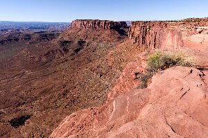
Grand View Point

We started at the Green River overlook, where the morning light was just right for highlighting the colors of the valley floor, almost 2000 feet below.  From here we drove to the end of the road at Grand View Point Overlook, stopping along the way at a couple of other overlooks.   At Grand View Point we walked along the rim trail for about 4 km, stopping at many, many beautiful outlooks over the purple tinged valley.

image

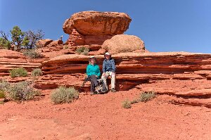
Lunch spot at the White Rim Overlook

Next we drove to Buck Overlook, which I thought was where we’d hiked and eaten lunch last year.  It wasn’t.  We drove back a couple of kilometers to the picnic grounds, which was where the White Rim Overlook trail starts.  We hiked to the end of the point, and stopped at a very nice warm spot below a big rock to eat our lunch. 

image

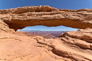
Mesa Arch

After finishing lunch we walked in to Mesa Arch, and then stopped along the way back at Shafer Canyon overlook.  We watched the cars going up and down the narrow winding switchbacks, and one bicyclist who was coming up.  He must have been very fit, as the road is quite steep and we saw him ride continuously from the bottom to near the top, where we lost sight of him.

Posted in Going South, 2013 | Comments Off on Islands in the Sky, September 28

Arches National Park, September 27

image

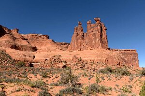
The three gossips

It was still cloudy this morning, but the clouds were moving out so it was clear in the west.  However it never really warmed up today, and it was windy, though not as windy as yesterday.

image

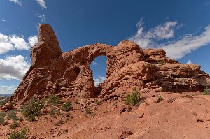
Turret arch

We drove to Arches National Park and stopped first at the Park Lane turnout, but there was no room to park, so we continued on to the Courthouse Towers parking lot.  We walked back along the trail towards Park Lane, through the huge rock walls and towering pillars in this area.  The light was perfect for photography, and the sky a clear blue.  We then drove to the Windows arches area.  We had to circle the parking lot once in order to get a spot, as it was packed.  Then we walked around the towers, and took the primitive loop which takes you to the backside of the North and South windows.  There were many, many less people here, and it was a very nice view out to the east over the desert.

After lunch we walked to the Double Arch, but it was starting to get rather cool as clouds had moved in and the wind was strong.  It must be quite cold as there is snow in the mountain peaks.  We then drove on to the Fiery Furnace, and up to Skyline Arch which we hiked in to.

We went in to Moab to get gas, and find a Laundromat.  I also looked to find a Verizon dealer, as our cell phone reception has not been very good, and I was looking for an alternative.  However, you can’t get prepaid on a 4G phone, which seems incredibly stupid.  Nowhere in the world is this the case, except in the United States.  You can go to third world countries, and buy prepaid sims in every grocery store, but not here!

Posted in Going South, 2013 | Comments Off on Arches National Park, September 27

Dead Horse Point, September 26

image

Along the West Rim trail

We left Green River this morning, and fortunately the wind was down, though it increased throughout the day and is now very strong again this evening.  It is only 90 km from where we stayed last night to our campsite at Horsethief.  Curiously we got exactly the same site as last year.  It had been vacated today, and since it is one of the nicest sites in this campground we were happy to pull in to it.

image

Meander in the Colorado River

After a game of scrabble before lunch (which Enid won as usual) we drove to Dead Horse Point State Park, which is about 15 km south of here.  We looked at the displays in the visitor center and then walked around the East Rim and West Rim trails, which took us in a loop around both sides of the canyon.  The views down to the canyon floor and the Colorado River were very nice.  We also drove into the campsite to check it out.  We are happy we are in Horsethief, for the Dead Horse Point campground is not nearly as level, and the sites are very crowded together.  The only advantages it has are electricity (but we have our generator) and water (but we filled up in Green River) which don’t outweigh its shortcomings.

image

Solution potash mine evaporation ponds

At the visitor center itself you can see ponds at the bottom of the canyon.  They are very bright blue, and I assumed that it was blue plastic liners for a sewage treatment plant.  However, when Enid watched a video in the information building we found that they are actually evaporation ponds for a potash mine.  The mine, a solution mine, pumps the brine into the ponds, adds cobalt chloride to it to make it blue and absorb sunlight better, and then lets the water evaporate.  After that they collect a slurry of potash from the evaporation ponds with large earthmoving machines, and then further process it.

Posted in Going South, 2013 | Comments Off on Dead Horse Point, September 26

Goblin Valley, September 25

Enid at Goblin Valley

Enid at Goblin Valley

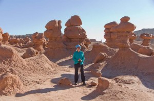
We drove to Goblin Valley this morning, about 70 km to the south west of us.  By the time we arrived it was very windy.  The forecast for today (and unfortunately for tomorrow as well) has a wind warning, with wind gusts up to 50 miles per hour.  They certainly were that strong today, and the desert area was hazy with blowing dust.  Our teeth were gritty as we walked around the “goblins” which are a very large number of short hoodoos.

Goblins

Goblins

If you can say, “I’ve seen one goblin, so I’ve seen them all” then you need not look at the more than one hundred pictures I took today.  Each of them is different, looking at the rock formations from different angles.  We walked around for quite a while, despite the wind.  It was quite easy walking, relatively flat between all the mushroom-like shapes.

Temple Mountain

Temple Mountain

After the hike we drove back to the visitor centre, where they have a few displays and a large relief map of the area.  I thought it would be interesting to drive across the desert, but after we ate lunch and started on the road, the pavement suddenly ended after a couple of miles.  We drove on a very rough and rocky road for a little while, but when we came to the first place I could find to turn around, we stopped.  It was at the base of Temple Mountain, which apparently was the site of a uranium mine until about 1970.

The wind has not abated at all.  Enid is suffering, as it is making all of her joints ache.  It is warm, over 28 C, but the wind has been wicked.

Posted in Going South, 2013 | Comments Off on Goblin Valley, September 25

Green River, September 24

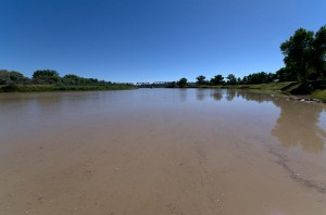
Green River at Green River

Green River at Green River

We are gradually working our way farther south, and it is getting warmer.  Today we crossed over a high mountain pass at 9100 feet.  It seemed like it wasn’t as steep going up, but it certainly dropped on the way south.  Here in Green River we are a bit over 4000 feet.

We got some bolts from the local hardware store to fix the bike rack, which had started to have a bad jiggle.  This town is very small, much smaller than I had expected, and seems quite poor with many closed stores.  After I’d fixed the bike rack I went for a ride, the first one, but it’s the first time we’ve taken the bikes off.

The campground is very nice, though some of the sites are hard to get into.  We are just tightly tucked in beside a big tree.  When we arrived there were a lot of sites, but now at evening it is quite full.

The Green River

Posted in Going South, 2013 | Comments Off on Green River, September 24

Starvation Lake, Utah, September 23

image

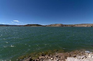
Starvation Lake

Today was a travel day.  We left Bear Lake and drove through the border country between Utah and Wyoming towards Evanston.  It is cattle country, high and it would be dry, except that parts of it are irrigated.

At Evanston we stopped and bought a new electric heater for the trailer.  The old one we had was very unreliable, and last night quit working after a few minutes of use.   Since it went down to 2 C overnight we needed the warmth.

image

Red rock cliffs along the highway

The drive was very pretty.  Along the way we passed a lot of red rock areas.  As we turned off I80 to highway 40 we started to climb over the Wasatch mountains.  We went to 8020 feet, before descending to Starvation Lake at 5750 feet.  This campground has a few more people in it than the one we were in last night, but not many.  We are in what seems to be a very new part of the campground.  We aren’t quite sure what the cost is.   The sign says both $23 and $28, but when we walked to the other campsite by the beach, each site was posted at either $20 or $16.  They were obvious, but this one is not, so we paid the $23.

The lake is a reservoir.  A few boats were out on the lake, but not too many.  It was very windy this afternoon as we arrived here.  The sky is clear, and it wasn’t too warm out today, so it may be colder tonight.

Posted in Going South, 2013 | Comments Off on Starvation Lake, Utah, September 23

How High can a Buffalo Jump? September 22

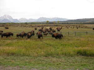
Bison jumping fence near road in Grand Teton park

Bison jumping fence near road in Grand Teton park

This was the question posted on the bulletin board at the Moose Visitor Center the other day, and we know the answer today — at least four feet.  As we left Grand Teton Park this morning we saw a large herd of bison, on both sides of the road, and of course many cars stopping to photograph them.  Actually it was necessary to go slowly, since the bison were also crossing the highway.  On the right side of the road was a pasture with a fence, and a number of horses.  The fence had a log rail at the top, about four feet from the ground, and the bison were jumping over it as we drove by.

After a brief stop in Jackson, Wyoming to get a LOT of groceries (we haven’t bought much for almost two weeks since there wasn’t much in Yellowstone or Colter Bay to buy) we drove along the Snake River to Bear Lake, Utah.  The drive was very beautiful for the leaves are turning their fall colors and the hills were colored reds, yellows and oranges.

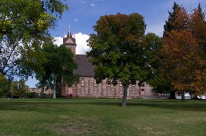
Paris Idaho Tabernacle

Paris Idaho Tabernacle

We stopped in the very small town of Paris, Idaho to take a look at the historic site of the Paris Mormon Tabernacle.  Designed by one of Brigham Young’s sons, it was built between 1884 and 1889 it is constructed of red sandstone hauled from over 18 miles away on sleds in the winter over the ice of Bear Lake.

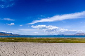
Bear Lake, Utah

Bear Lake, Utah

We got to the Rendezvous Beach campsite on Bear Lake at about 3 pm.  It is a huge campsite, and virtually empty.  There are only about 4 units camped here tonight.  The lake is very large and a pretty blue.  We walked along the beach, which is far out from the shore line since the water is low and the beach slopes very gently.

Posted in Going South, 2013 | Comments Off on How High can a Buffalo Jump? September 22

Taggart and Bradley Lakes, September 21

image

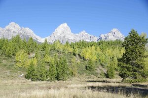
Teton Range and fall colors

It was our last day in Grand Teton National Park, and it was a gorgeous one.  The sky was cloudless until after noon, and very warm.  At lunch a few cumulus clouds started to build, but it remained warm all day, the warmest we’ve had in the greater Yellowstone area.

We hiked to Taggart Lake first this morning.  It was gorgeous as there are many golden trembling aspen contrasting with the dark green conifers and the brilliant blue sky, all against a backdrop of the Teton range.

When we got to the parking lot there was a large group of people, twenty or so, getting ready to hike.  Most of them were older people (read our age, or slightly older) and they got on the trail just before us.  We soon passed some of them, and were not more than 200 metres down the trail when I heard someone fall behind me.  I turned and it was a woman in her 70’s who we had just passed.  Some of the others in the group asked her if she was all right, and she said that she was not, as she’d hurt her arm and shoulder.  I yelled ahead to the group and got them to come back and help her.  Some of them must have continued on the hike as we saw a few, but not all, of them later on.

image

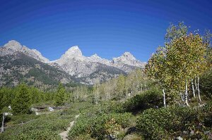
On the trail to Taggart Lake

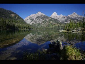
We shortly met a young couple from England.  We visited with them for a bit, waiting for other hikers to clear so we could take pictures.  When we came to the junction to Taggart lake we went left and they went right which is a shorter route to Bradley Lake.  Taggart Lake is not large, but it was beautiful with the Tetons in the background.

image

Taggart Lake

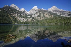
After taking many pictures we continued on.  The trail climbs around the end of the lake over a large moraine, then climbs a couple of hundred feet, before dropping down to Bradley Lake.  Again the view was beautiful across the lake.

image

Bradley Lake

We continued on, walking across the bridge at the end of the lake, and heading up towards where it looked as if we could see a waterfall.  However, after a climb of another couple of hundred feet it was obvious that the waterfall, though we could hear it, was not visible.  We came down the hill a way to where there was a huge fallen log off the trail.  We ate lunch here in the warm sun.  A few other hikers passed us here, but nowhere near the number that we saw on the shorter much more used trail to Taggart Lake.

image

On the trail down

As we were leaving we saw a hawk soaring above us.  There were now a few clouds in the sky, so the views of the mountains with the golden poplar leaves in front were now different.  Every corner I would stop, look back to the mountains, and take more pictures, for every angle gave a different and spectacuar view.

We leave tomorrow, and will be heading towards Utah.  For the next couple of weeks we plan to be in the red rock region of the Utah desert.  

Posted in Going South, 2013 | Comments Off on Taggart and Bradley Lakes, September 21