Cliff Dwellings, October 4

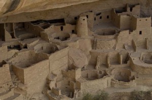
Cliff Palace dwellings

We spent the day visiting archaeological sites of the ancestral puebloans (Anasazi) here in Mesa Verde National Park.  We walked around many of the sites on self guided tours, and also went on ranger led tours of Cliff Palace and Balcony House.  I enjoyed the latter  more, as the tour guide was much better.  Enid did not go on this tour because it included scaling a 30 foot ladder, and then negotiating a climb up a narrow ledge hanging on to chains to exit.

It was amazing to see the number of structures, and how well built and preserved they are.  Given the size of the doorways and the dimensions of their rooms, they must have been very small people.

Posted in Going South, 2012 | Comments Off on Cliff Dwellings, October 4

Cell Phone Hassles, October 3

Ok, it would have been an easy day from Needles Outpost to Mesa Verde National Park.  That is it would have been easy if we hadn’t stopped in Cortez, CO to try and put more time on our Verizon USB modem so we can continue to update this blog.

First we discovered that our AT&T cell phone won’t work here.  We went in to an AT&T store to ask them why.  Answer: because we have a 2G phone and they don’t have anything that runs 2G here.  Of course they would be happy to sell me a 3G phone (which if I could actually get from AT&T, I’d have done when we were starting out in North Dakota).  So that is pretty useless.

Then I went in to a Verizon outlet, since I can’t get on-line with Verizon to add money to my account.  The store couldn’t get it to work either, so they gave me their phone and I called Verizon tech support.  After 20 minutes on hold, the technician told me that I can’t add money through their web site.  However, he would do it over the phone for me, if I gave him a credit card.  So I did that, and then he asked me for my ZIP code on the billing address for the card.  I said, “I don’t have a ZIP code, it’s not a US card.”  At which point he said, “well then give me a different card that has a ZIP code.”

At that point I came to the conclusion that I know the cause of the US financial crisis.  If everyone in the US thinks that the rest of the world works their way, no wonder they don’t get why they are soon to be one of the poorest of the developed nations.  You can’t be a world leader anymore by assuming the rest of the world works your way.  The US cellular system is terrible.  The rest of the world has long ago surpassed it.

Rant over.  We got to Mesa Verde National Park, and are checked in to a very nice campsite.  It is not very busy as it is end of season.  And to top it all off, they have free wi-fi in the campsite, so who needs Verizon anyway!

Posted in Going South, 2012 | Comments Off on Cell Phone Hassles, October 3

Biking and Hiking, October 2

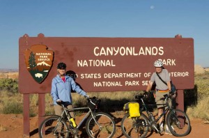
David and Enid at park sign

We rode our bikes this morning out the highway towards the east.  We stopped along the way to take pictures of many of the flowers that are blooming off the edge of the road.  Then on our way back we cycled to the visitor information center to see if they could identify the plants for us.  They did have some books that we were able to consult, and we thing we found most of them.  A couple though seem rather different than anything we could find.

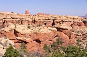
After lunch, which we ate in the trailer – biscuits, cheese, ham and jam – we drove to the end of the road into the park.  This is the start of the Confluence trail.  I was thinking we might hike it tomorrow, but it is too long, and if the trail is anything like it started, too rough to be much fun.  We did hike the Slickrock Trail, which is a 4.5 km loop trail that goes out to several viewpoints.  The trail guide identified the buttes and rock cliffs that can be seen in the distance, so we now know the names of some of the buttes we have been looking at for the last few days.

We stopped at the campground office, where Enid had a strawberry milkshake, a real milkshake made with an old Hamilton Beach machine.  It was delicious, and I know that, since I shared a good portion of it with her.

We thought we might stay one more day, but this afternoon after seeing that the remaining hikes are more difficult than we want, we have decided to leave tomorrow morning.

Posted in Going South, 2012 | Comments Off on Biking and Hiking, October 2

A Walk to the Park, October 1

The park information office had suggested that we walk the trail to Chesler Park to see the Needles, so that is what we did today.  We got to the trailhead by 9:30 hoping to avoid the heat of the day for our hike; however, it was still a very warm day.

Enid in narrow canyon

We had interpreted the distance, about 10 km round trip, as being an easy hike.  It wasn’t.  The path climbed and fell over many sets of stone steps, across slickrock ledges that fell off to the side, and through some tiny slot canyons.  One of the canyons was so narrow that you could barely squeeze through, your hips rubbing on the stone walls.  Overall it was probably the most difficult hike we’ve been on since Lake O’Hara this summer.

Rock formations along the Chesler Park trail

However, the views made the trip worthwhile.  There are huge numbers of mushroom shaped rocks along the way, red sandstone stems capped with a different kind of yellow-white stone.  Chesler Park is a large open area of desert grass and shrubs surrounded by “The Needles”, sandstone spires of alternating bands of red and white.  We ate our lunch here in the shade of a small juniper before heading back.

Posted in Going South, 2012 | Comments Off on A Walk to the Park, October 1

Needles Outpost, September 30

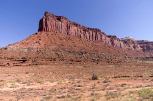
Mesas and buttes visible from highway 211, Utah

We didn’t plan to get away too quickly this morning, as we didn’t have far to go.  However, it took us far longer than we anticipated, as one of the leveling jacks on the trailer would not raise properly.  After trying to fix it for about an hour, I finally gave up, tied it up with some wire so that it couldn’t hit the ground, and then we left.

We stopped in Moab at a car parts place to get some iron wire.  The first store had none, but the smaller one right beside it did, so I bought a roll (far more than I need, but the smallest amount they would sell me).  I hope that I can fix the broken part, a “nut” that is supposed to hold the jack screw on the way up, but which is slipping.

We then drove towards the south part of Canyonlands National Park, the Needles area.  Along the way we passed Newspaper Rock, which is a stone wall with hundreds of petroglyphs scratched into the black rock varnish on the red sandstone.  There were a lot of very nice buttes along the way as we drove into the park.

We stopped at Needles Outpost, a primitive commercial campground just outside the park.  It is a very nice site, and we chose a spot right up against a high rock wall which rises sheer out of the sandy soil behind us.  There are very large junipers here that some of the tenters are using for shade, and which separate the sites to give some privacy.  The site is off the power grid, and they have a large bank of solar cells, as well as a backup generator for power.
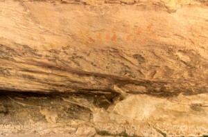
Hand outlines in red and yellow

After we were set up we drove into the park, stopped at the visitor center to get advice on how to spend our time here, which we followed and did three short hikes.   The first two made use of the geological feature of the area which is overhanging rocks, that provide a natural “roof”.  The first site, “Roadside Ruins” was an approximately 800 year old grain storage bin made of adobe and stones.  The second, “Cave Spring” is a large area several hundred metres long where the overhanging rocks were used as shelter, originally by the native Americans, but more recently by cowboys.  The rock roof was smoked and covered with soot.  A very small seepage of water allowed some green plants to grow in the cracks of the rocks, and a small amount of water had accumulated in a tiny pool.

In the oldest part of the Cave Spring site there were many pictographs.  There were hand prints in yellow and red on one spot on the roof.   In another area there were hand outlines that seemed to be made from soot, as the interior was the color of the rock, and the outline was in black.

Finally we drove to the Potholes area, and walked around.  While the potholes were all dry, there were more very interesting rock formations.  The rocks here remind me of many of the sites we stopped at in the desert of Australia.  The hand prints in particular are the only ones we’ve seen outside of those we first saw in Australia.

Posted in Going South, 2012 | Comments Off on Needles Outpost, September 30

Blue Sky, Red Sandstone, September 29

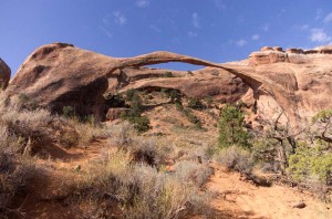
Landscape Arch

It was another gorgeous day, one of the warmest we’ve had since the very first day or two of our trip.  The sky was its deep desert blue mixed with the occasional brilliant white cloud as we toured for the second day in Arches National Park.

We drove up to the north end of the paved road, stopping first on the edge of the road below The Fiery Furnace and then at Skyline Arch.  We didn’t stay long, but by the time we got to the Devil’s Garden trail parking lot, it was almost full.  We took one of the last spots, right near the exit.

The first part of the trail, up to Landscape Arch (which is the largest arch in the world), is good.  From here on though the trail is much rougher, going over some very steep sandstone fins with sheer drops off the sides.   We took short side trips in to Partition Arch and Navajo Arch.  The former is a double arch that frames views out over the valley below.  I went all the way to Double O Arch, which really was hardly worth the effort, as it is an interesting enough figure eight arch, but not really as spectacular as some of the others we saw today.

We ate a late lunch back at the parking lot, on the one picnic table we found in the shade.  We’d thought the parking lot was crowded when we arrived, but by now it was jam packed with cars lining the road for at least a mile before the parking lot even started.

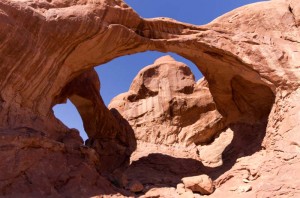
Double Arch

We drove to the Windows area, where there are a lot of arches, and from my perspective the most interesting and impressive ones we’ve seen.  I particularly found Double Arch intriguing, with a very interesting shape.

We built a fire and roasted “smokies” tonight for supper.  Unfortunately, we haven’t found tasty smoked sausages here like we get in Saskatchewan.  Perhaps they exist, but we haven’t had any luck in our search.  The ones we had tonight were a bit better than wieners — just.

Posted in Going South, 2012 | Comments Off on Blue Sky, Red Sandstone, September 29

Delicate Arch, September 28

The sky was beautiful and clear today, great for our drive to Arches National Park.  We stopped first this morning at the viewpoint for the appropriately named Big Mesa, which is a very long mesa beside the highway we drive towards Moab.  Then we continued on into the National Park, and drove up towards the beautiful red sandstone cliffs standing tall against a deep blue sky.

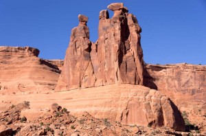
The Three Gossips

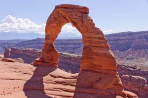
There are many tall pinnacles in the first part of the park.  I particularly enjoyed “The Three Gossips”.  A little farther on is “Balanced Rock”, and then the highlight of our day, “Delicate Arch”.

We first took the easy route to the lower viewpoints.  This is not a very long walk, but it also only gives a very distant view of the arch.  After lunch, which we ate in the shade of a small bush beside the very full parking lot, we climbed the two kilometre walk up to the much better viewpoint for Delicate Arch.  A lot of it is a climb up a slope of slickrock.  The last little bit winds around the backside of a rock where they have cut a trail about a metre wide that drops off sharply on the outside edge.

Delicate Arch

This is the most famous of all the Utah arches, and is the one they have on their license plate.  It was hard to get a good picture of the arch, as there were so many people there taking their picture against the arch.  Finally, after waiting my turn, and asking some people to move, I got a good picture.

We finished early today, drove back to Moab to get some groceries, and then stopped to get propane on the way back.  One of our tanks ran dry right at breakfast this morning, which was good timing or the refrigerator would have been off all day.  We decided that we will go back to Arches National Park tomorrow, our last day in this area before we go to the Needles section of Canyonlands National Park.

Posted in Going South, 2012 | Comments Off on Delicate Arch, September 28

Islands in the Sky, September 27

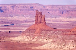
Candlestick Tower overlook

A gorgeous day, and far too many pictures was the result!  We drove to Canyonlands National Park, the Islands in the Sky division, which is just south of us and spent the day driving to viewpoints and hiking short hikes to vantage points to see the canyons.

The canyons were breathtakingly beautiful today, all shades of reds and browns, with the most distant views tinted blue from the very light atmospheric haze.  Their scale is immense, and you are high above the canyon floor 1600 feet below you.  And that is not the bottom, for that canyon floor is cut by even more canyons dropping hundreds of feet more.

We started the morning at Mesa Arch.  It isn’t a difficult hike, but it does climb uphill over a good deal of slickrock, sand, and many stone steps.  A man and a woman were wheeling a young man of about thirty, probably their son, in a lightweight “wheelchair”, built much like a racing wheelchair, but built for rugged duty use.  We passed them at some of the stairs, where they were resting.  I offered to help, but they declined, and they made it to the top not long after that.

White Rim Overlook trail

We drove on to Grand View point which is the end of the road, and walked another mile out to the very end.  The view is spectacular, and immense, with canyons dropping off hundreds of feet below on all sides as far into the distance as one can see.

After lunch we continued on exploring the canyon views.  Our day ended at the upheaval dome, a  1500 foot deep “crater”, possibly formed by a meteorite impact.

Tonight it took a very long time to go through all the pictures I took today.  There are so many different views of the canyons from differing angles that it will take me a while to decide which are the ones I really like.

Posted in Going South, 2012 | Comments Off on Islands in the Sky, September 27

A Rainy Morning, September 26

Views while Mountain Biking

Although it cleared last evening, it had become cloudy by morning, and got cloudier still by the time we finished breakfast, and soon started raining.  I tried to start the generator, but it wouldn’t keep running.  I noticed that the oil level light flashed as it was starting, so checked and saw that it was low on oil.  We drove back to the highway where there is a service station, and bought a quart of oil, as well as a cup and a plastic bottle.  I used these to change the oil (the generator only takes 250 mL, so it isn’t much) and it is running fine again.

We used our oven to make freshly baked biscuits and had soup in the trailer for lunch, as it was cool out.  By the time we had finished it looked as if the weather was improving, so I got my bike ready and went for a ride down the dirt road which leaves from the campground.  I travelled about 10 km towards the Green River, hoping that I would find some high viewpoint of the canyon, but didn’t have much success.  The scenery was pretty with large buttes in the distance, junipers and pinion pines, and a lot of bare rock.  Eventually the trail got so sandy and soft that it was very hard riding.  I had to push up most of the small inclines, so at that point turned back. 

On the return trip I could see a truck parked on the road in the distance.  When I got to it, I found that there were two workmen in the truck sleeping.  I think that they were supposed to be exploring for oil, at least that’s what the truck’s logo suggested.  I imagine they were probably sleeping on company time.

By evening the sky was becoming quite clear.  We lit the campfire tonight, and Enid roasted marshmallows.  We sat outside until we finally got too chilly.

Posted in Going South, 2012 | Comments Off on A Rainy Morning, September 26

Horsethief Campground, September 25

After the rainstorm

It was a short drive, just a couple of hours today, to bring us to the north of Canyonlands National Park near Moab, Utah.  We are in Horsethief Campground, a BLM campsite just outside the national park, and half a mile in from the pavement on a good gravel road.  It is a very nice place to stay, though it has no water, but we knew that so came prepared.  We plan to stay here until Sunday.

The weather today was unsettled and stormy.  We drove through a heavy squall, but it was nice by the time we arrived here and set up.  After lunch we went to the national park, the visitor center of which is about seven miles south of us.  As we left the visitor center we could see a large dark cloud to the west.  Though it didn’t rain on us, we only went to one viewpoint, and decided that the weather was too threatening, so we returned to the trailer.  On the way back it started to rain, and we saw one major lightning strike.

The storm didn’t last long, but another one passed through as we were preparing and eating supper.  It rained quite heavily for about half an hour, and there was a very nice double rainbow to our east.  It now feels quite cool out tonight.

Posted in Going South, 2012 | Comments Off on Horsethief Campground, September 25