Colorado National Monument, September 24

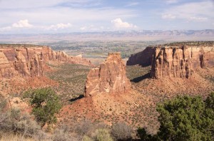
Independence Monument from Grand Viewpoint

Although it rained during the night, the first rain we’ve had since we left Canada, it was partially clear this morning.  That was nice, since we drove the Rim Rock Drive through Colorado National Monument today, a 23 mile long, stop at every viewpoint drive, to photograph the beautiful red sandstone cliffs and monoliths.  These pictures are available at http://www.digipac.ca/pictures

We walked a couple of the short hikes at viewpoints, not much, just a kilometer or so at each one.  For lunch we walked the trail to the Coke Ovens viewpoint.  If we hadn’t seen the charcoal kilns in Death Valley last year, we’d have had no idea why they call these features the coke ovens.  However, their bee-hive shape certainly does look something like a charcoal kiln.

It sprinkled a bit in the early afternoon, but hardly enough to wet the ground.  However this evening it did rain for a couple of hours, a thunderstorm as we were making supper, and it got quite windy.

Posted in Going South, 2012 | Comments Off on Colorado National Monument, September 24

Fruita, Colorado, September 23

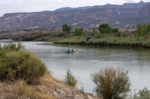
Rafters on the Colorado River in Fruita, CO

It was overcast for most of the day, true clouds this time and not just smoke haze.  It has been warm here, in the high 20’s C every day, but it gets much cooler at night, going close to freezing.  I suspect it won’t be as cool tonight as the sky is overcast.

We stopped at the Colorado Visitor Center in Dinosaur, Colorado this morning.  It was a chance to use the Internet since we’ve had no access for the last four days.  I caught up the blog.  We also picked up a lot of visitor information for southwestern Colorado.  Then we drove south on Colorado highways 64 and 139.  The middle section of highway 139 is the steepest highway we have driven on.  It rises to over 8268 feet in a fairly short distance, then drops again on the south side just as quickly after passing the summit.

We stopped at the James M Robb State Park, Fruita Section.  This is one of several state park sections on the Colorado River.  It is an urban park, just on the outskirts of the small town of Fruita.  We walked along the river bank and saw some rafters floating down the river.  The river is quite small here at this time, so they weren’t travelling very fast.  There are a number of small “lakes” by the river, but unfortunately they are closed to swimming as they are contaminated with E. Coli.

Posted in Going South, 2012 | Comments Off on Fruita, Colorado, September 23

Hiking the Red Wash, September 22

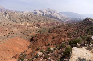
Red Wash and Split Mountain

We hiked along the Green River this morning north from our campsite to the Split Mountain group campsite.  There is a large section of this campsite that is closed and hasn’t been used for a long time.  The rest of it is marked as group camping, though there seemed to be one large RV in the campground that likely isn’t group camping.  It has been there the whole time we’ve been in this area.

Enid was startled by a small deer on her left that jumped up just as we entered the campsite.  The deer didn’t seem to be able to walk well.  It must have some kind of a leg injury.  It stood and watched us, so we walked on not to stress it any more.

We stopped at the Split Mountain boat ramp.  This is a huge paved area that is used as a takeout from the Green River.  There are at least half a dozen number loading areas on the ramp.  Signs indicated that you should take all your gear out quickly at one of these numbered spots, and not interfere with other groups.  Though the ramp was empty this morning, there must be times when it is very busy from rafters coming down through the river canyon, given its size. There were at least a dozen trucks with empty raft trailers in the parking lot there.

From there we hiked the Desert Voices nature trail.  This is a trail that is signed with some interpretive signs, but mostly statements about ecology and wilderness in particular as it relates to the desert, and the role of a national park.  While I agreed with their sentiments, I couldn’t help but think that it was preaching to the converted.  I am sure that most of the people who would take the time to walk this trail would already be sympathetic to the views expressed.  I thought that perhaps the statements need to be learned by the many over-consuming RVers that never make it to the campsites in the National Parks.

Posted in Going South, 2012 | Comments Off on Hiking the Red Wash, September 22

Echo Park, September 21

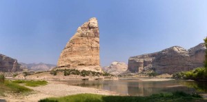
Steamboat rock at the junction of Green and Yampa rivers

We drove east this morning to the very small town of Dinosaur, Colorado, where we turned north, re-entered the National Monument and drove up the Harper’s Corner road.  We stopped at the information center to pick up a tour booklet, then tried to find the nature trail, because there are supposed to be white tailed prairie dogs.  However we couldn’t find the trail, and ended up asking a park ranger where it was.  It turned out to be across the road, and we walked it for about two minutes before deciding it was a waste of time.  If there are prairie dogs there, they definitely weren’t showing their heads this morning.

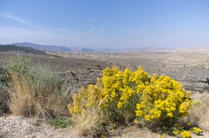
It was not a very good day for driving to all the high overlooks over the canyons in this part of the park.  Once again today it was very hazy with smoke from the fires north of here in Idaho and Wyoming.  The distant views of the mountains described in the tour book were not visible.  We could however see the closer up formations made of very bright red and white sandstone, and the changing fall colors of the foliage.  We also did see some sage grouse, and the white tailed prairie dogs we were looking for.

After lunch we drove down the narrow dirt road to Echo Park.  It has very steep switchbacks at the start, and is very rough with large stones in the road.  We were glad we were in a four wheel drive with good clearance.  The drive was slow but well worth the time.  After the initial descent the road passes through a deep yellow sandstone canyon.  It then passes by the ruins of the Chew ranch, abandoned in the mid 1960’s when the land was sold to the national park.  Some of the buildings, including an old sod roofed shack were still there.

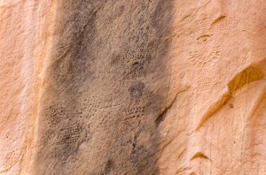
Pool Creek dot pattern petroglyphs, Feemont culture

Just before reaching Echo Park the road passes by a high sandstone cliff.  About 30 metres above the ground are many dot pattern petroglyphs.  They are believed to be made by the Freemont culture about one thousand years ago.  The dot pattern carvings in the rock are very intricate, the most intricate stone work we’ve ever seen.  The patterns seem to represent faces perhaps wearing headdresses and necklaces.  It is hard to see how they were made as they are far above the ground on a sheer cliff.  The interpretive sign suggested that there were rocks here that they stood on, and that the rocks have been eroded away.  That seems questionable to me, for it would be very unusual to get that much erosion in a thousand years.  There is absolutely no sign of any rocks that fell from the wall.

Echo Park was the site of a huge ecological battle in the 1950’s.  A dam was proposed for this area which would have completely flooded the gorge.   Building such a dam within a National Monument would have violated the principle on which national parks were founded.  Fortunately, from an aesthetic perspective the environment won, as it is a beautiful area where the Yampa and Green rivers meet.

After supper tonight we went to the ranger talk by the river.  He talked about the wild west days of cattle rustling and thievery that lasted here until about 1910.  One of the most notorious of the outlaws was Butch Cassidy.  Probably the last of the outlaws in this area was Josie Bassett, whose cabin we were at yesterday.  She was notorious as a cattle rustler, bootlegger, and female rodeo competitor.

Posted in Going South, 2012 | Comments Off on Echo Park, September 21

Dinosaur Quarry, September 20

Douglass dinosaur quarry museum

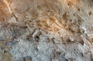
I have never seen so many dinosaur bones in one spot, actually I’ve probably never seen as many total dinosaur bones, as there are on display in the dinosaur quarry at Dinosaur National Monument.  We arrived at the visitor center just in time to take the first shuttle, a short five minute ride, to the building which was built to showcase the dinosaur quarry here.  Discovered in the early 1900’s by Earl Douglass, the quarry exposed many complete dinosaur skeletons.  So many fossil bones were discovered here that eventually the quarry was closed to further digging, as it was becoming redundant.

Instead of an active quarry, the site was turned into a museum where the bones of the dinosaurs lie in thousands visible on a rock wall over which a building was constructed.  A ranger gave us a quick introduction to the site, and then we walked through ramps in the building looking at and photographing the bones.

We went on a ranger led hike through the hills surrounding the museum.  The ranger explained the various geological formations, and pointed out fossils, some tiny clams found in the river bed, and other larger dinosaur bones, including one large femur.  Some of the tour participants spotted other bones, one of which the ranger had not seen before.  I’m sure that the illustrators for “The Flintones” either were here, or saw photographs of this area, because it looks very much like Bedrock!

Fremont culture rock petroglyphs

After lunch we drove through the southern part of the National Monument on a self-guided auto tour.  We saw a large number of petroglyphs carved by the Freemont people.  Like most rock art we’ve seen, the figures of humans have a body that is very wide at the shoulders, tapering to a narrow hips.  The body almost looks triangular, but isn’t quite.  However these are the most intricately carved works that I’ve ever seen.  Some of the faces showed a great deal of decoration, including what appeared to be necklaces.

At the end of the road there are the remains of an old homestead which belonged to Josie Bassett (also known as Josie Morris).  She lived there until 1964 when she died at 89.  The story told about her in the guide book painted her as a rather colorful character, with five husbands, and twice charged with cattle rustling.

Posted in Going South, 2012 | Comments Off on Dinosaur Quarry, September 20

Flaming Gorge, September 19

Views of Flaming Gorge, Antelope Flats

I had read on the Internet that Highway 191 between Rock Springs, Wyoming and Vernal, Utah was the “scariest highway in the United States”.  Don’t believe everything you read on the Internet!  The road is really beautiful, and not a bad drive at all.

From Rock Springs you first climb up atop the high plateau, then drop about one thousand feet down to the Flaming Gorge Dam, then climb back up about 2500 feet before dropping sharply into Vernal.  Except for the last part of the road, the trip was easy.  There are 10 sharp switchbacks with a speed limit of 20 mph and an 8 to 9% grade on the way down.  However the road didn’t seem that hard to drive.

We’re glad we came across it, because the road has beautiful views.  Until you reach the dam you get expansive views over the Flaming Gorge with its red rock cliffs.  The next section of the highway was through a high mountain forest of lodgepole pine and aspen.  The aspen were beautiful shades of golden yellow and bright orange-red against the contrasting dark green of the pines.  The sky was blue, and though there is a lot of smoke haze that obscured very distant views, the mountain forest was still lovely.

As the highway drops down to Vernal there are several phosphate mining operations.  At one of these there was a viewpoint out over the Green River valley below at Vernal, and the mining operation on the mountain cliffs behind.

Green River

We stopped in Vernal at River Runners, a store we’d seen advertised in a pamphlet we picked up at the dam visitor center.  They were advertising water shoes, which both Enid and I wanted to buy.  We walked out of the store with new shoes each, and as well I got a nice pair of flip-flops.  The price was reasonable to begin with, and everything was on sale at 20% off.

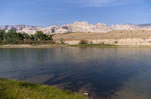
From Vernal it’s just a short drive to Dinosaur National Monument.  We are camped in the Green River campground, and after we’d set up our trailer, we went for a short stroll along the river.  The high rocks of the mountains form a nice backdrop to the river.

Posted in Going South, 2012 | Comments Off on Flaming Gorge, September 19

Smoke Gets In Your Eyes, September 18

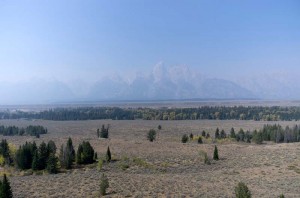
Grand Teton through smoke haze

We had plans to be in Grand Teton National Park until next Sunday, but forest fire smoke has changed our itinerary.  We awoke this morning to a cold, but nice sunny morning in Yellowstone.  Our plans were to do our laundry (which we did), then arrive at the Colter Bay campground at around noon (which we did), and stay there for a week (which we didn’t).

The farther we drove south from Yellowstone, the smokier it got.  By the time we got to Colter Bay the smoke haze hung heavy obliterating any distant views.  We stopped at the campsite registration office, debated our plans to stay, and since the registrar said that it was smoky every morning and evening, she also agreed with our decision not to stay.  She recommended that we go to the Gros Ventre campground on the south side of the park, as she said it was less smoky there.  However as we got closer we could see that there was very little point to staying here, as the beautiful Teton mountains were so obscured by smoke that they were hardly visible.

So we drove on south through Wyoming, travelling through the mountains along the Hoback River for the first part of the trip.  This was very beautiful, as the leaves of the poplars are turning golden.  Only the smoke haze marred the view, though it did get less as we got farther south.  Then upon leaving the mountains one drives for about 150 km through the high desert of Wyoming, at an altitude above 6000 ft, most often over 7000 feet.

We stopped in Rock Springs, Wyoming at a KOA campsite.  It seems to be the only RV park in this town, so one doesn’t have a lot of choice.  It’s nice enough, but pricier than most places we’ve stayed.

Posted in Going South, 2012 | Comments Off on Smoke Gets In Your Eyes, September 18

West Thumb Geyser Basin, September 17

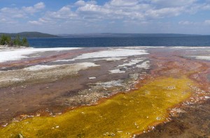
Colored stream entering Yellowstone Lake

After a week of viewing geothermal formations, it would be easy to skip another, yet each one has something different to offer.  Today was no exception as this afternoon we visited the West Thumb Geyser Basin which is right adjacent to our campsite, only a kilometre and a half in a straight line, though quite a bit farther than that by road.

Since it was cold and cloudy this morning we stayed in the campground.  I walked to Big Thumb Creek which is just half a kilometre north of our campsite hoping to spot some wildlife.  I followed along the lake shore, but all I saw was a lot of ducks and some Canada Geese.

It cleared by noon so we drove to the West Thumb Geyser Basin and looked at the features there.  None of the geysers are active, but there are a number of very hot thermal springs, very brightly colored.  The area is unique because the geothermal activity is right at the lake shore, and even right in the lake water.

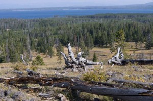
View of Yellowstone Lake from the overlook

After about half an hour here we hiked a short 2 mile hike to the Lake Overlook.  This climbs a rise that gives a great view out over Yellowstone Lake.  The area was burned in the 1988 fire, but it is now starting to regrow with many lodgepole pine trees about ten to fifteen feet high.

Enid walked to Yellowstone Lake just before supper.  She came back in just a few minutes to get her camera, as there was a bull elk and a couple of females on the shore.  I took the video camera and got some great shots of the bugling bull elk, which had an enormous rack of antlers.  A female was right next to where we were photographing, less than 100 feet away, and she was catching the bull’s attention so he faced directly toward us.

We leave Yellowstone tomorrow, though we are not travelling far.  For the rest of this week until next Sunday we will be in Grand Teton National Park, which is just a short distance to the south.

Posted in Going South, 2012 | Comments Off on West Thumb Geyser Basin, September 17

Norris Geyser Basin, September 16

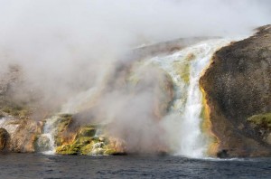
Springs runoff into Firehole River

Once again we spent the day at geothermal features as we drove north past Old Faithful to some of the geyser basins we hadn’t yet visited.  It wasn’t nearly as cold overnight and was about 4 C when we left this morning, but it also didn’t warm up nearly as much today.  It was very hazy, some clouds, but mostly smoke from all the forest fires burning around this area.  There is a large fire in the national park to our north about 30 km away, and one south of Jackson Hole, Wyoming.  Yesterday was very warm, dry and windy, so these fires both grew.

Our first stop was at the Midway Geyser Basin.  Because of the cool air there was so much steam over the hot springs and pools that it was difficult to see much.  However the colors of the water in the Great Prismatic Spring were so intense that they colored the fog above the pool pink and turquoise.  As well the water running over the rock flowed through many colored streams stained by the different kinds of thermophile bacteria.  Where the water flows over the edge and into the Firehole River was very colorful.

We drove north past Gibbon Falls, a beautiful drop through a gorge beside the road, and on to the Norris Geyser Basin.  We couldn’t find a picnic table near the parking lot (it turns out there aren’t any in the entire area) so we walked through a stand of young trees newly grown since the 1988 fire to a small clearing where we ate our lunch in isolation.  It was a nice spot, and there was a small hot spring fuming and bubbling just a few feet in front of us.  The fire must have come incredibly close to the old museum.  We walked through it, though it is very small and doesn’t have a lot of exhibits.

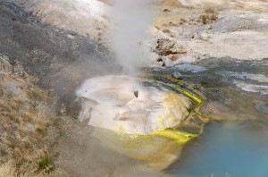
Ledge Geyser

The Norris area has many pools and springs, and also some geysers.  However the geysers were not very active.  Steamboat, the largest geyser in the world is in this basin, but it hasn’t erupted since 2005.  The Porcelain Basin is a large flat plain surrounded by low hills, all of them in various shades of white and grey, interspersed with blue, green and yellow pools of water.  The colors in the water running from the hot springs were very bright.  We walked through this basin, and then took the longer loop by Steamboat Geyser, and numerous other hot springs and thermal vents.

After about two hours here we drove the short distance north to a small museum, “The History of the Park Ranger”.  It is in a small log building that was built in 1908 as one of the patrol stations in the park.  It had displays of a number of general artifacts about various US National Parks as they related to the history of how the Park Rangers.

Finally on the way home we stopped at Firehole Falls to take some more pictures.  We probably didn’t take as many photographs today as we sometimes have.  The light wasn’t as good since the sky was hazy all day with smoke.  However, Enid and I still took a lot, probably a couple of hundred between the two of us.

It is much cooler tonight than it has been.  It began to sprinkle rain, and though it is not heavy, it will be of some help in putting a damper on the forest fires.

Posted in Going South, 2012 | Comments Off on Norris Geyser Basin, September 16

Yellowstone Canyon, September 15

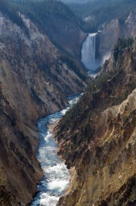
Lower falls, Yellowstone River from Artist’s point

Every day has brought us something new in Yellowstone National Park.  Today our plan was to go to Yellowstone Canyon, and we did get there.  However along the way there were a great number of very interesting things to observe.

We have been shocked by the variety of things we have seen.  We knew we’d see some geysers and hot springs, and expected to see a bit of wildlife, but the number and diversity has amazed us.  We thought we’d be doing some hiking, but instead every day we have walked and walked many kilometres just exploring all the paths around the places we’ve been.

This morning started with a bull elk and his harem.  On a sandspit that runs for a couple of kilometres across a bay in Yellowstone lake, there were half a dozen cows and a bull with a large rack of antlers.  The reflection in the lake made a pretty picture (to see this and the other pictures I’ve taken on this trip, go to http://digipac.ca/pictures and go to the 2012 section).

Shortly after that we spotted a coyote hunting.  It pounced through the grass, jumping up and landing with it’s front paws.  We didn’t see it catch anything, but it certainly wasn’t very concerned about the large number of cars that had stopped to watch and photograph it.  It is easy to find the wildlife.  Just look for fifty cars all stopped at all angles on the shoulders, or even right in the middle of the road!

Next we saw a large chocolate brown grizzly bear that was wading in the river.  There was also a herd of bison in the same area.  We’ve seen many bison, in all the parks we’ve been in on this trip.  They are all pretty tame, but the size of the big bulls is still intimidating.

We also stopped in the Mud Volcano area.  Here one of the most interesting sights (and sounds) was the loud pulsating roar of steam from the Dragon’s Mouth Spring.  There were several mud springs here, the largest of which is Sulfur Cauldron, a huge boiling mudpot.  It lived up to its name, for the smell of hydrogen sulfide and other sulfur compounds is very strong.  It certainly took me back to my research days at the university!

By lunch we did reach our goal of Yellowstone Canyon, and after we’d eaten we toured the visitor center.  It has a number of very interesting displays about the volcanic activity here, and how much it influences everything about the park.  We then drove around the loop drives to see the canyon and falls, and we walked to a large number of viewpoints. 

The canyon is spectacular, as are both the upper and lower Yellowstone falls.  The canyon walls are made of colored stone, much of it yellow and thus giving the river and the park its name.  The view from each of the viewpoints gave a different look at the walls of the canyon with its multicolored rock, and the falls and rapids of the Yellowstone River.

Posted in Going South, 2012 | Comments Off on Yellowstone Canyon, September 15