Mammoth Hot Springs, September 14

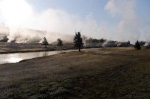
Early morning geyser steam

We left a bit earlier this morning than we have been, to drive north all the way to Mammoth Hot Springs.  Because it was earlier, it was also colder.  Steam was thick as we drove through the upper geyser basin near Old Faithful, and the grasses had a light coating of frost.  It was a very beautiful picture this morning.

We arrived at the upper terraces drive at the hot springs just about 10 am.  It was a bright sunny morning as we walked and drove around the many pools and brilliant white deposits of travertine.  Many of the deposits were as bright as snow, and looked much like a snowy winter morning.  The springs are actively depositing new travertine.  In many places the rock has completely surrounded and killed the trees, leaving old greying snags sticking out of the brilliant white rock.

Palette Spring

At other springs the white deposits are stained by minerals and the bacteria which grow in the water into many shades of yellow and brown.  The colors were the most varied at the Palette Spring, including not just yellows and tans, but pink and blue as well.

After lunch we walked around the lower terraces, and nearly climbed as high as we had started this morning on the upper terraces.  There were many beautiful springs where new deposits are being formed, and some older ones where the water is no longer flowing.  It was one of the most spectacular things we have seen on this trip.

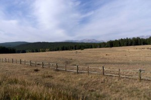
We returned by driving across the road to Tower-Roosevelt.  This is a very different part of the park, much more open with vast views across grassy plains with scattered trees.  The road climbs to a summit over 8800 feet high, and you can see for miles in all directions out over the forest, much of it burned in 1988, on one side, and the more open prairie towards the Yellowstone River on the other.

Posted in Going South, 2012 | Comments Off on Mammoth Hot Springs, September 14

Hot Steam and Cool Falls, September 13

Iron Spring Creek

We saw a variety of things today, though all involved water in some way.  First this morning we stopped at the geysers and hot springs of the Black Sand Basin.  It was quite cool this morning, so the hot steam formed great clouds of white above many of the features.  Iron Springs Creek flows through between the geysers, and the name reflects the rusty stain where hot water flows over the rocks and into the creek.

Sapphire Pool

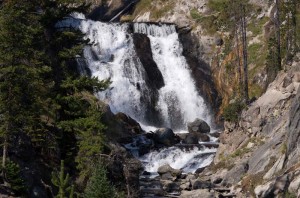
From there we drove on to the Biscuit Basin, where we saw the beautiful blue water of Sapphire Pool underneath a cloud of steam.  We continued on past the end of the boardwalk along a hiking trail for another one and one-half kilometers to Mystic Falls.  The last kilometer of the trail follows the Little Firehole River until it reaches the falls.  They are a large cascade at least 25 metres high, with several smaller drops above that.

Mystic Falls

We ate lunch when we had returned to the parking lot, at one of the few picnic tables we’ve seen, overlooking the Firehole River.  A large bull bison was scratching against a dead tree, and many tourists were photographing him.

After lunch we continued on and drove around the Firehole Lake drive.  One of the highlights of this tour was Firehole Spring, where the boiling water deep below the surface of the water flashes white in the sunlight, and looks very much like a flame below the water.  We continued on by Firehole Lake where geysers spout hot water continuously into this tiny pond.  The hot water then flows on over terraces, the hot steaming water forming the Hot Cascades.

Finally we stopped and walked the loop trail around the Fountain Paint Pot.  The geysers and clear hot spring pools here in Yellowstone are much more numerous and spectacular than those we saw in New Zealand.  However I wasn’t nearly as impressed with the mud pot.  New Zealand’s were far better.  Just past the paint pot was Red Spouter which spat reddish mud a couple of feet into the air.  However, right next to it, and much more impressive than the spurting mud was a roaring fumarole where escaping steam made a deafening roar as it escaped from a hole in the ground.

Posted in Going South, 2012 | Comments Off on Hot Steam and Cool Falls, September 13

The Geysers of the Old Faithful Area, September 12

Grand Geyser

We decided that we would visit the world’s most famous geyser, Old Faithful, today.  We had no idea of the huge number of spectacular geysers, steam vents, and hot pools we would see in the same area.  It was a cool day, starting out below freezing at -2 C, but it was very sunny, not too windy, and by afternoon was about 15 C.

When we got to the Old Faithful Visitor Education Center and checked the schedule for eruptions, we saw that Grand Geyser was predicted to erupt in just under half an hour, as was Old Faithful.  Since Grand only erupts once or twice a day we decided to walk the kilometre and a half to that geyser.  It was well worth the effort and quick walk, as it erupted just shortly after we got there.  It was a powerful eruption of water that shot in several bursts high into the sky, and lasted for almost ten minutes.

After that we walked back and saw Castle Geyser which was erupting a bit, but mostly just ejecting a short column of water a couple of metres above it’s cone.  We continued on back, intending to eat our lunch.  When we got to the Old Faithful area could see a huge crowd gathered there, as well as a park ranger giving an introductory talk, so we decided to watch.  It erupted within five minutes of our arrival, so it was well worth delaying our lunch for a few minutes.

Grotto Geyser

After lunch we walked north to eventually arrive at the Morning Glory Pool, so named because it looks like a morning glory flower.  Along the way we saw a lot of hot springs and geysers.  One of the nicest was the Grotto Geyser.  It was not in full blown eruption, but did shoot out many bursts of hot water every few seconds.

From Morning Glory Pool we walked back and our day enjoying the geysers was at an end.

Posted in Going South, 2012 | Comments Off on The Geysers of the Old Faithful Area, September 12

Travelling to Yellowstone, September 11

The flags in front of most of the offices we passed today were at half mast.  I questioned Enid as to why, and she reminded me that it was September 11, so this is the 11th anniversary of 911.

Travelling through the Bighorn Mountains

We drove across Powder Pass in the Bighorn Mountains.  At 9,666 feet it is almost a mile higher than Buffalo, Wyoming where we started, so it was a steep climb and you could tell on the Tahoe.  Pulling the trailer up the hills made it work.  It was a nice day to drive as it was a bit cooler than it has been for the last few days.

We were delayed twice by construction, and having to wait for pilot cars.  The first time , on the east side of the pass, there didn’t seem to be much work taking place.  However at the second, across the mountain range, they had the road ripped up, and wetted down.  The Tahoe and trailer got very muddy, so when we stopped for gas in Worland I asked where we could find a carwash.  We spent about fifteen minutes washing the vehicles.  Unfortunately I got a big spot of grease on the back of my shirt from the hose.

Once across the mountains the topography changed to be a very dry desert.  Around a few of the towns they were irrigating and growing crops of grain and sugarbeets.  Outside of this irrigation it was very brown.  It is also quite flat, just gently rolling hills until you get to Cody, Wyoming.

Breccia cliffs along the Shoshone River

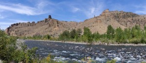
At Cody you reach the edge of the mountains.  Buffalo Bill played a large part in the formation of the town.  There is a large museum there about him, but we didn’t stop as it was still a good two hours drive to our campsite.  As you leave the town you pass the Buffalo Bill Dam on the Shoshone River which forms a large lake.  Past the end of the lake you travel through the canyon of the Shoshone River, a very beautiful drive into the east entrance to the park.  The highway again climbs as you reach the park entrance until you reach Sylvan Pass at 8350 feet.  Then the road drops down to the elevation of Yellowstone Lake at about 7700 feet.  The forest along this highway is largely burned from the 1988 fire.  You drive through burned out areas for many miles.

We reached our campsite at Grant Village about 4 pm, set up our trailer and then went to the visitor center to get some information.  It is supposed to be cool tonight, probably dropping to -5 C.  That is a big change from the last few days when it has been around 33 C during the day, and last night was 10 C.

Posted in Going South, 2012 | Comments Off on Travelling to Yellowstone, September 11

Jewel Cave, September 10

Jewel Cave Formations

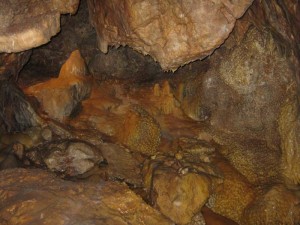
We got away early enough this morning that we reached Jewel Cave before it opened at 8:30.  We bought tickets and took the first tour at 9:20.  The tour lasted about an hour and a half and took us on a circular walk through the cave.  Unlike the part of Wind Cave we saw, this was much more open with larger chambers.  It is also quite a bit wetter, so that there is more flowstone.  There were a lot of steps, and we walked up and down a good deal.

From there it was on to Buffalo, Wyoming, which we reached in the early afternoon.  As we approached town we could see the smoke of a forest fire to the west of the city.  There is quite a large fire about 10 miles to the northwest of the town.   We washed clothes and then stocked up with groceries for our trip to Yellowstone.

We read on the Internet tonight that there is a large fire burning in Jackson, Wyoming.  We are not sure if that will affect our plans to go to Grand Teton after Yellowstone or not.  In any case we will be in Yellowstone Park tomorrow night.

Posted in Going South, 2012 | Comments Off on Jewel Cave, September 10

Scenic Highways, September 9

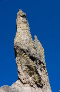
Cathedral Spires

We drove the scenic loop today around the narrow, twisted mountain roads surrounding Mount Rushmore.  We started the day in Custer where we caught up on our email since that was the first Internet access we’ve had for a couple of days.  Then we drove out highway 16A towards Custer State park, where we purchased a state park entry pass for $15, then travelled up the Needles “highway” towards the Cathedral Spires.

The road has three very narrow tunnels.  On two of them we had to fold in our mirrors to get the Tahoe through.  The Cathedral Spires are the highlight of this section of the road.  They are sharp crags of granite that jut up from the mountains.  Some are very close to the road, and we stopped at almost every available pullout to photograph them.

We stopped at Sylvan Lake to eat our lunch.  There were several vacant picnic tables, so we picked one to eat at.  We had no sooner got our sandwiches out than we learned why the tables were vacant.  We were swarmed by many yellow jacket wasps!  So we quickly packed up our lunch and went back and ate it inside the Tahoe.  We watched other groups stop to eat their lunch, saw them swat once or twice, then hurriedly pack up and retreat to their vehicles.  Wasps five, tourists zero!

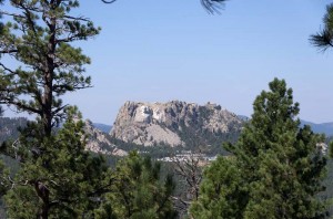
Mt. Rushmore from Norbeck Viewpoint

After lunch we drove on to view Mount Rushmore.  However, having been there before, and since the parking fee was eleven dollars, we decided to skip the main tourist area.  We drove around the Iron Mountain highway, which also has three narrow tunnels (though wider than those on the Needles highway).  These tunnels are intentionally created to frame the Mount Rushmore sculpture, so that you can see it if you look back through the tunnel.  We also stopped at the Norbeck Overlook (and learned that Peter Norbeck was an early governor of  and state senator for South Dakota) where you can also see Mount Rushmore quite clearly, even though you are several miles away from it at this point.

We then stopped at the visitor information center and viewed the exhibits there before continuing on around the wildlife loop road.  We saw no bison, but we did see several burros.  We also saw more tourists than burros, including an entire tour bus that has stopped and was out petting them.  The burros are very tame, and must be used to being fed, for as soon as you rolled down a window to photograph them they would come right up and almost stick their head in the window.

As we pulled back into our campsite at the end of the day, we saw a large tour bus ahead of us.  We were curious about why a tour would come into the campsite, but soon found out.  It was full of young teens, grade seven and eight, from a Montessori school in St. Paul, Minnesota.  They are on a tour to start their school year and camping here, all fifty or so!  The first thing they managed to do was break the water tap.  Somehow they opened it too far and jammed it wide open.   One of the teachers came by and wondered if I knew where the camp host was (there is none), so I offered to see if I could fix the faucet.  However all I did was make it even worse, jammed it even farther open, and got thoroughly soaked.  The teacher drove to the cave information center, and about half an hour later a repairman showed up.  He couldn’t fix the tap either, but did have a tool to shut the water off.

Posted in Going South, 2012 | Comments Off on Scenic Highways, September 9

Touring Wind Cave, September 8

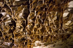
Boxwork calcite formations

We took the first tour this morning of Wind Cave, starting at 9 am.  Along with about 25 others, and a ranger, we climbed down a couple of hundred feet along stairs and narrow passageways into the cave.  The cave is quite dry, and has no large stalagmites or stalactites, but it does have many intricate calcite formations known as boxwork.  These are a honeycomb of square formations several inches deep which hang from the roof.  There were also tiny frost like crystals of calcite on some of the rocks.

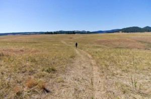
Enid on the Lookout Point trail

After the tour was completed we went for a hike through the Black Hills and the prairie.  The trail followed a creek in a valley for about half the walk.  It was cooler here, which was nice as it was a very warm day today, near 30 C.  We ate lunch in the shade of the ponderosa pines while sitting on a bridge over a dry creek.  After lunch we continued on and the terrain changed to rolling prairie grass and open stands of ponderosa pine.  We saw several prairie dog towns along the way.

Looking east, the change from forest to prairie

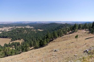
At the completion of this hike, it was still fairly early, so we drove to the north end of the park and walked a one mile nature trail up Rankin Ridge to the top where there are spectacular views out over the prairie to the east where the pines give way to grassland.

We’d heard about listening to elk bugling tonight at the cave office this morning, and just before 7 pm a ranger came by to invite us to attend.  We quickly washed up the dishes and walked down to the amphitheater to hear the ranger talk.  However since it involved a drive for some distance we decided not to continue with it, so came back to our trailer.

Posted in Going South, 2012 | Comments Off on Touring Wind Cave, September 8

Wind Cave National Park, September 7

Mule deer in campsite in evening

We arrived here without any further incident with the brakes, so we certainly hope they are properly fixed.  For much of the drive it was through rolling hills and prairie until we reached Deadwood, South Dakota, where the terrain changes dramatically as you enter the Black Hills.

After driving south from Custer we reached a sign that said “Wind Cave National Park”.  Shortly after that our GPS told us to turn to the left, so we did.  In about another kilometer it told us we had reached our destination, which was obviously not true, as we were on a narrow road in the middle of the prairie.  We continued on until we found a place where we could back up the trailer onto a side road and turn around.  We stopped a vehicle and asked them if they knew where the campground was.  They replied that they didn’t, but that the park office was just a way further back on the highway which we had just turned off.  So we headed back out to the main road, and found the campsite.

The campground is almost empty, but there aren’t a lot of sites that are really good for trailers or larger RV’s.  We picked out a site on the side of the road, which is on quite a slope, so we had to jack the front of the trailer quite high to make it level.  After we were set up we went to the park office and inquired about cave tours which we hope to do tomorrow.

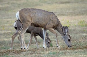
It was a very nice evening.  A mule deer doe and two older fawns were eating grass right outside our trailer.  At first we thought she must have had twins, but a while later another doe came by, so perhaps one of the young was hers.

Posted in Going South, 2012 | Comments Off on Wind Cave National Park, September 7

OK so far, September 7

Well we’ve travelled about 25 miles this morning to Belfield, where we have Internet access, and the brakes seem to be working ok.  At least the drum isn’t hot, and we’ve heard no squeals of burning rubber, so touch wood!

We are heading to Wind Cave National Park today, and should arrive there in mid-afternoon.

Posted in Going South, 2012 | Comments Off on OK so far, September 7

A Scenic Drive, September 6

Little Missouri River

The mobile mechanic arrived about 10:30 this morning.  We hope he fixed our brakes.  When he removed the wheel, he could find nothing wrong at first, but then noticed that the brake adjustment lever was out of place.  He knocked it back to where it should be, and readjusted the brakes.  I hope that it has fixed the problem, and we’ll know first thing tomorrow morning when we leave.

After lunch we drove around the scenic loop drive through Theodore Roosevelt National Park South Unit.  Along the way we stopped at several spots to take photographs, and do some short hikes.

Our first stop was at a large herd of bison.  There were a number of cows and some calves, together with a few bulls.  There were also many prairie dogs there.  I took a lot of video.  Then we drove on to the Ridgeline trail.  This is a fairly steep climb up to a high viewpoint.  The trail is quite short, only about a kilometer.  It overlooks the entire park in a 360 degree panorama.

Next we stopped at the Coal Vein trail.  This is where there was an underground fire in the lignite coal.  It burned from the early 1950’s until 1977.  Red clinker called “scoria” is left behind.  We then drove to another very high viewpoint, Buck Hill.  There is another impressive overlook over the park after a short hike to the top of the hill.  There were two large bison bulls at the top of the hill.

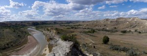
One of the nicest views of the day was near the end, at a short hike along the Wind Canyon trail.  This leads to an overlook of the Little Missouri River.  There were many bison on the hills to the north.  I thought about how similar it must have looked to this, one hundred and fifty years ago before the land was opened up and the bison almost exterminated.

Posted in Going South, 2012 | Comments Off on A Scenic Drive, September 6