Trailer Brake Troubles, September 5

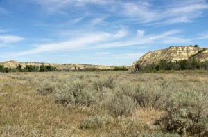
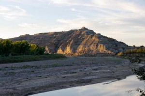
Hills and buttes

We left the North unit of Theodore Roosevelt National Park this morning, and drove south on highway 85 towards Belfield, North Dakota.  There was a great deal of heavy truck traffic, especially trucks hauling wide loads of oil field equipment.

We stopped at Belfield for gas, and since there was Verizon wireless signal there I phoned and got the USB modem reactivated.  It took quite a while, but once we had it going we were able to email everyone, and posted the last few days of the blog.

We drove on to Medora, which is a very small town, mostly just hotels and service industries.  After entering the park we stopped at the visitor center to check on activities.  Then we headed north about 5 miles to the Cottonwood Campground.  We missed the turn as the sign says “Cottonwood Picnic Area” so we went on thinking that there would be another entrance to the campground.  There wasn’t.  We had to go another mile in order to get a place to turn around, and then returned to the campgrounds.

As we turned the corner into the campground we heard a squeal, and I looked back and saw that the trailer tire was smoking.  We stopped, and when we started again everything seemed fine, but we hadn’t gone another 100 yards when we felt the trailer brakes grab again.  We backed up a few feet, the brakes released, but once again after driving just a little way they locked, leaving a streak of rubber on the pavement.

We drove once around the campground loop looking for the best site and the brakes grabbed a few more times, but not as hard.  However on the next loop they locked up again firmly.  We could tell by now that it was just one tire, the front right, which was causing problems, and it was happening at random intervals, not when I applied the brakes.  It is the same brake that heated up when we were in Kananaskis in July.  The right front brake drum was very hot.

We set up our trailer in a nice site, then unhooked the truck.  We drove to see if we could find the campground host to get advice on where we might get repairs in this very remote area.  I spoke to a park ranger, and he said there would be nothing closer than Belfield.

Belfield is 25 km back on the Interstate highway, and there is no way that I would want to pull the trailer there with faulty brakes.  Instead we called our Good Sam roadside assistance.  After talking to a trailer technician, he advised that we would need to get a mobile mechanic to pull the wheel and find out what is happening.  They have set that up, and so we should get some assistance tomorrow morning.

Since we really couldn’t leave as we had to wait to see if the mechanic would call us, Enid stayed at the trailer and worked on her photographs from Hawaii, while I hiked up to the top of the buttes to our east to see if I could find some buffalo.  I did find several grazing on the top.  I also stepped on what looked like solid clay to cross a creek, but which turned out to be very soft underneath.  I sank over my ankles and got my shoes and lower pant legs thoroughly plastered with sticky clay.  It was mostly dried by the time I returned to the trailer, but I washed my pant legs and socks in the washroom sink and hung them out to dry.  They were very dirty.

Posted in Going South, 2012 | Comments Off on Trailer Brake Troubles, September 5

Prairie Dog Town, September 4

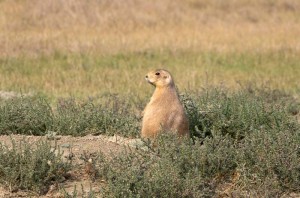
Black tailed Prairie Dog

There was almost no wind this morning, a very light haze of clouds, and cool temperature when we left on a hike to the prairie dog down along the Buckhorn Trail.  It is about a kilometre from our campsite to the trailhead, and then another 3.6 km to the town, through prairie that skirts along the edges of the coulees.

At least it would have been that far had we not lost the trail in the middle and walked almost an extra kilometre trying to find it again.  Near the middle of the trail we went down a small coulee to a nearly dry streambed, and then the trail forked.  The main trail seemed to go to the right, so we followed it, but it soon petered out and was nothing more than an indistinct animal trail.  We retraced our steps to the top of the hill, and could see a couple of sign posts off in the distance to the left.  However, we couldn’t see any sign of a trail that way.  After walking back a way on the trail to prove that we hadn’t missed an earlier fork we returned along to the bottom of the coulee, went to the left, crossed the dry stream bed, and followed a very indistinct trail through the grass that did pass the signposts.  After about another kilometre we met up with a much better trail coming in from the Caprock Trail parking area, and a clear signpost that indicated it was about another 800 metres to the prairie dog town.

We spent about an hour in the town photographing the prairie dogs.  They were large and fat and not very frightened of us.  We were able to approach quite closely.  Occasionally they would jump high in the air and bark, but they were not very noisy.  They mostly sat and ate the grass by pulling it out by the roots, while watching us to make sure we didn’t get too close.  If we did then they would scurry away a short distance and continue eating.

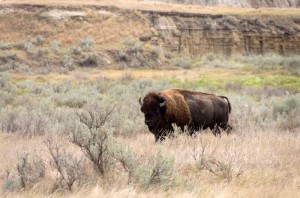
Large Bison Bull

It was too early to eat lunch here, so we walked back to the junction  On the way back we saw a huge male bison, only about a hundred metres away.  He walked slowly by us without paying much attention, as we watched.  Then we took the Caprock Trail which starts with a kilometre long nature trail, so we picked up a trail brochure and followed this trail to where the nature trail portion ends.  Here we ate our lunch, then returned back.  By now it was quite cloudy and almost looked as if it could rain.  It didn’t fortunately, as the clay trail would be extremely slippery if it was wet.

We made an arrow on the ground crossing the wrong trail, out of stones, and pointing in the correct trail direction at the junction where we’d made the mistake in the morning.  As we finished this a man came up the trail following after us.  He was trying to get to the prairie dog town on the Buckhorn Trail, but was going completely in the wrong direction, so we told him how to get to it.

When we got back to the campsite we had new neighbours.  They came by and we talked to them for some time.  They turned out to be retired teachers from Wisconsin, and the man was a former band teacher.  They told us about their travels, and we ours (we have travelled a lot more than they have).  They did tell us about Rocky Mountain National Park in Colorado, and we thought about going there after Grand Teton, but we decided it will probably be too cold this late in the year, so will not go there this time.

Posted in Going South, 2012 | Comments Off on Prairie Dog Town, September 4

Juniper Campground, Theodore Roosevelt National Park North, September 3

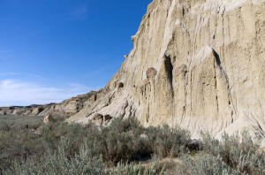
Cannonball concretions

It was very pleasant as we left Weyburn this morning, as unlike yesterday there was almost no wind.  We saw many hawks along the trip to the border, sitting on power poles, on bales, and in the few trees.  The highway is reasonably good though it has very narrow shoulders.

We shopped for groceries in Williston, then went to the AT&T store to try and buy a cell phone.  While we could get the phone, we couldn’t get a reasonable data plan.  All our options for prepaid allowed you to get almost no data, and to get a monthly plan we would have had to give them a deposit of $500, and then we’d have gotten a plan with no messaging.  We thought about it over lunch and decided not to bother with the phone, just top up the time we have on our ten dollar GoPhone.  Instead I thought I would activate the Verizon USB modem that I have.  However, I couldn’t do that as the number has been reassigned, and so I waited on hold with an assistant for a while.  Since I was afraid that I would run out of time on the phone, I asked if there was a Verizon store in Williston.  The operator suggested that we try Walmart.  So back we went, and now the store, unlike this morning when we got groceries, was really busy.  We waited in line for almost half an hour, and then the clerk said he couldn’t help us anyway.  So we left Williston no further ahead with no access to the Internet. 

As it turned out we won’t need the Internet here, as there is no cell phone access in this park at all.  It is quite remote.  It is also very pretty.  As soon as you turn into the park you are driving through badland buttes.  We picked a campsite that overlooks the Little Missouri River.  After setting up we went for a hike along a nature trail that overlooks the river.  It wasn’t too far and an easy walk that goes by some good badland formations.  Just after we’d started the hike we saw a lone buffalo drinking from the river.

Sunset on buttes and Little Missouri River

It was warm today, about 28 C, but this evening was very pleasant.  Enid saw some wild turkeys that were down by the river, and the sunset was nice, though not spectacular.

Posted in Going South, 2012 | Comments Off on Juniper Campground, Theodore Roosevelt National Park North, September 3

On The Road Again, September 2

We left Prince Albert this morning after doing the last load of laundry.  It was very windy today, and we started out almost directly into the wind so it took lots of gas.  As the day progressed the wind shifted to be more of a cross wind, and then it was behind us as we approached Regina.

Since we are crossing the border, and don’t want to have anything with us that might be questioned, we stopped in Saskatoon to leave a load of vegetables for Graeme.  That was the last of the produce from our garden this year.  There will be lots more cucumbers until it freezes, though I doubt that many of them will be eaten.  Everything else was cleaned up.

We stopped just before supper at the Weyburn Walmart, where we will spend the night.  After we’d parked we went for a 45 minute walk.  Along the way we found two bungee cords, one broken but I repaired it, so we brought them back with us in case they turn out to be useful at some point.

Posted in Going South, 2012 | Comments Off on On The Road Again, September 2

Early Morning on the Water

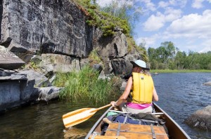
Enid at rock paintings below Stanley Mission

We awoke at 4 am.  It was still dark out, and the wind was already up.  Although it had been quite calm by about 11 pm last night, sometime in the early morning the tent started flapping in the wind.  Neither Enid nor I had great sleeps as we lay worrying about the weather.

Since it was still pretty dark I cooked breakfast with my headlamp on.  A bat flew by.  It was just starting to get light as we left at 5:30.  The wind was from the south west, the direction we would be paddling, but it wasn’t nearly as strong as yesterday, so we were able to make headway.

We crossed the largest open stretches without incident, though we had to work hard against the wind.  Then we were able to sneak in around islands for a ways and avoid the worst of the wind.  The strongest wind hit us as we crossed Drope Lake.  The wind was now shifting towards the northwest, so it came straight across the lake.

We portaged on the roller portage at little Stanley rapids, then paddled to a point just west of the rock paintings to eat lunch.  Several boats were fishing near here, as well as a large group of canoes that was out looking at the rock paintings.  As they were clambering all over the rocks I commented, “it’s a wonder that the paintings have survived all these years without damage, given how many people don’t know how to look after them.”

While we were eating a boat came by close to shore and quite fast.  Its wake hit the canoe which was sitting on the rocks and tossed it around a bit.  After lunch we paddled in to Stanley.  By now the wind was either down, or had shifted so that it no longer was a problem for us to paddle into.

A full boat of tourists were unloaded at the dock.  Just as we arrived another boat arrived with all their gear.  They had so much with them that I commented sarcastically to Graeme, “they must have been out for a month.”

I picked up the Tahoe, got a bag of ice for our fish, then we loaded up our gear.  On the way out of Stanley we stopped at the Co-op to buy a pop.  I was struck by the lack of any good food in the store, though they did have a huge stack of cases of pink marshmallows right by the door.  They were labeled in Spanish, so I’m not sure where they originated from, but not likely in Canada.

Paddled:        21.4 km

If you’re looking for a few pictures of the trip, they’re online here.

Posted in Summer, 2012 | Comments Off on Early Morning on the Water

Wind Bound

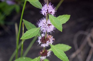
Wild Mint at campsite

It rained more during the night. This morning was sunny, but it was very wet in the bush with lots of water falling from the trees every time the wind blew, or you shook their branches. Although we got up at 6:30 we did not get away until 9 because it took longer to pack up the wet gear.It was starting to get windy by the time we were on the water. The wind got much stronger all morning. It didn’t bother us much at first, since we were quite sheltered by the islands at the north end of the bay, but as we approached the west end of Drinking Lake it began to be a strong headwind.

We reached the portage which was in very poor shape. We debated wading up the tiny shallow creek, but instead decided to portage. I cut down small poplars and willows at one point on the trail. There was a steep rocky ledge of about 1.5 m to get over. The trail was not well used, so in retrospect it would have been a lot easier to wade up.

The next portage is in good condition and wide open, though the pole skids which are there have really started to deteriorate. The old wooden rollers have mostly rotted away. The west end of the portage is quite shallow, and it was harder for Graeme to get away than Enid and I. I just gave the canoe a hard push and jumped in.

We paddled to the next point after the portage and ate lunch. After that we paddled past the cabin out to the main part of the lake, and no further. The lake was very rough with large waves and whitecaps, and our direction of travel would have been directly into the wind. We looked for a place to camp, but there was nothing so we went back to the cabin site.

The ground was covered with blueberries, especially where we were going to pitch our tents, so we picked them. After we had the tents up Graeme and I went fishing, while Enid stayed on shore and picked more berries. She got about 5 litres of berries, and we caught lots of fish, but only one walleye. We kept enough jacks to take lots home, plus what we would eat for supper.

We cooked on the gas stoves tonight, and didn’t start a fire. I also baked two bannocks in the backpacker over.  There’s a sign posted here that is almost illegible as it is so faded.  Graeme thinks he pieced out the letters to read “Private Property No Camping”.  Oh well, we can’t leave in a canoe!

It is still very windy. It is less than it was during the day, and we could now probably paddle against it. However, we plan to get up early tomorrow morning, so should be able to get away.

Paddled: 7.6 km
Camped: 13 U 546754 6141379

Posted in Summer, 2012 | Comments Off on Wind Bound

Drinking Lake

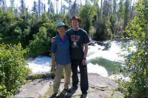
Enid and Graeme at Nistowiak Falls

We were up at seven and on the water by nine. We first went in to Nistowiak Falls, then paddled on to Potter Rapids. It was a sunny day with a light wind from the south west, so it was easy paddling.We made the portage by dragging the canoe over the skids, and carrying the kayak. There are small rapids below the portage. Enid and I hit a large eddy and turned back upstream, but were fine. We then ate lunch at a point (just before the fallen over cross).

We paddled on to the island at the east end of the lake (13 U 552004 6139368) intending to camp there. However, I walked all over the end of the island and couldn’t find anyplace nice to stay. I thought this was where Enid and I stayed in 2006, but I could find no sign of a fire pit. [This is surprising, as on reading my diaries when I returned home I found that we stayed here in 2001, as well as Graeme and I in 2003.] We talked to some fishermen that were here in a boat, but they didn’t know of any campsites in the area either. We paddled back towards the north, looking at many island areas but really couldn’t find much that was nice. At one point we went through an area marked as the path between two islands, but it was very shallow, and we had to pole hard to get through the shallow weedy water. I thought Graeme, Geoffrey and I had camped on the point at the north end of Wium Bay (13 U 551666 6142642) but that didn’t look possible at all. We finally found a site on the side of the mainland, but it was fairly high and didn’t have a good place to set up a tarp. We paddled a long way out of our way looking for a site.

A couple of canoes came by from the north as we were pitching our tents. They looked at the island across from us, but then continued on. They must have come down the Drinking River.

Graeme and I went fishing after supper, but caught nothing except weeds. It started to sprinkle rain not more than 15 minutes after we got on the water, so we came back in. We quickly got everything put away, and then it started to rain heavily. We got into our tents since we had no tarp set up. It is not late, only 7:30, but it looks like we are socked in for the night.

Paddled: 23.6 km
Camped: 13 U 550885 6142373

Posted in Summer, 2012 | Comments Off on Drinking Lake

Nistowiak Lake

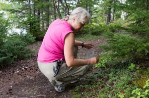
Enid picking lowbush cranberries

We left Prince Albert in a very heavy rainstorm this morning.  It rained very hard overnight and we heard on the news that Weldon had 128 mm of rain.  However, by the time we got to La Ronge, the sky was clear.

We drove to Stanley Mission, eating our lunch along the way, and arrived at the town at about 11:30.  After we’d unloaded our gear, I parked the Tahoe in a pay parking spot for $5 per night.

As we were completing loading our canoe and kayak, a couple of vehicles arrived pulling a trailer with five Sea-Doos and a boat.  They had gear that looked as if they were also going camping.  They passed us on the water just after the church.

There were a couple of boatloads of tourists at the church taking pictures.  They also passed us before we’d reached the first narrows.  Later on we saw them returning just as we reached Frog Narrows.

The Sea-Doos passed us, then one seemed to be having trouble.  They circled around for a while, then a couple of kilometers down the lake turned back and we saw the boat towing one of the watercraft back.  We were actually glad to see them go since they were noisy, but mostly we were worried that since they looked as if they planned to camp they would beat us to any good campsite.

We camped at the point north of Nistowiak Falls.  The site is nice and clean and doesn’t seem to have been used too much.  After the tents were up Graeme and I went swimming, while Enid slept.  Then we cut and split wood and once Enid was up made supper.

There are a few low bush cranberries here, so Enid picked after supper and got a couple of cups of them.  They aren’t quite ripe, but perhaps will ripen over the next few days when we get home.

It was a very nice evening with almost no bugs.

Paddled:        13.2 km
Camped:         13 U 539040 6140843

Posted in Summer, 2012 | Comments Off on Nistowiak Lake

Canoeing with Graeme, 2012 style

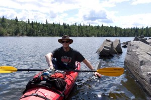
Graeme in kayak at rock paintings below Stanley Mission

I’ve been canoeing for over 40 years in Northern Saskatchewan, keeping a journal for almost every trip, but never publishing any of it.  One reason is that there isn’t any Internet access (well, there could be if one carried a satellite phone, but I’ve never even thought about doing that) over most of the area, except around the small settlements, so it didn’t seem too practical.  I’d have to wait until I returned to “civilization” in order to publish anything.

Graeme (my son) has accompanied me every year of his life somewhere on a canoeing adventure, starting when he was less than a year old.  Occasionally the trips have been little more than a day on the water, but generally we go on a somewhat longer trip than that.  Of course the ultimate trip we did was in 2003 when we took six weeks to cross the province on the Churchill and Sturgeon Weir rivers, including a hike across the Methye Portage.

This year we only had a long weekend which Graeme was able to extend by an additional day of holidays, so we decided to travel downstream from Stanley Mission into Drinking Lake, and then return.  We didn’t really have a destination in mind, but rather planned to go as far as the weather would allow, and then return.  With those plans, Enid, Graeme and I set off on August 3, with Graeme in a kayak, and Enid and I in the canoe.

Now that we’re back, I think I will publish my journal for this trip, so if you read this, let me know!

Posted in Summer, 2012 | Comments Off on Canoeing with Graeme, 2012 style

Iceline Trail, July 22

The Yoho Valley from the Iceline Trail

This morning was clear and beautifully sunny.  We didn’t rush around to get ready to hike,
in fact, we weren’t sure where we were going to go.  I thought about going to Takakkaw and doing part of the Iceline trail.  We stopped at the park office in Lake Louise to inquire about the trails around Moraine Lake, but since they all require hiking in a group of four, that was out.  The interpreter in the office suggested that we go high to the Iceline Trail because of the good weather forecast, so that is what we did.

From the parking lot at Takakkaw Falls, which was almost completely full and so we were just barely able to squeeze our vehicle into a tight spot, we walked the kilometre or so to the start of the trail up the west side of the valley.  We climbed up switchbacks on the clay trail, which was slippery because of the rain, until we reached the junction to the Yoho Lake campsite.

The trail soon flattened out beyond this point.  We stopped for lunch partway to the lake, then continued on to the tiny lake.  There were three women there eating lunch and heading to Emerald Lake.

Enid is sure that the one young woman was a guide, since she was much younger than the other two, and very knowledgeable about the trail.  She told us there were a couple
of trees down across the trail, and she was partly right.  There were four downed trees.  One was too high to step over, and I tried to go around it.   That was a mistake, as I
ran into a sharp tree branch, ripped a hole in the back of my shirt, and have a
10 cm long scratch on my back.

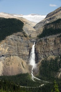
Takakkaw Falls from the Iceline Trail

The trail climbs again after leaving the lake.  Near the top there was a considerable amount of old snow, just where the trail flattens out a bit.  Several runners passed us on the flatter
sections just after this point.  There are great views of Takakkaw Falls at this point as well, just before it reaches the junction with the Iceline Trail.  We joined the Iceline trail and climbed up it for about half an hour before heading back.

Since the weather forecast tomorrow is poor, and we’ve about exhausted the hikes right around here, we’ve decided to head home tomorrow.

Posted in Summer, 2012 | Comments Off on Iceline Trail, July 22