Catalina State Park, Tucson, November 23

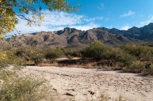
Santa Catalina Mountains, Catalina State Park, Tucson, Arizona

It was a very nice warm day today, probably the warmest we’ve had with a temperature near 25 C.  We drove from Tombstone this morning, and stopped to get gas about half way to Benson.  While at the service station Enid asked where we could get some pecans, since they grow them in this area.  The attendant said “look for the orange van parked on the side of the road.”  We saw the orange van, but it wasn’t on the road.  It was parked in an RV site, and there was no one visible, so we just continued on up the road to a nut and fruit stand we’d seen on the way in.  We did get a big bag of pecans there for a pretty reasonable price.

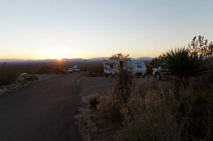
We arrived in Tucson before noon, bought groceries, ate lunch and then headed out the few kilometres north to Catalina State Park.  It is a very nice campsite, with lots of open space between sites, and even a few trees.

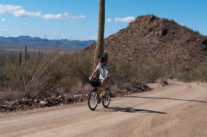
After setting up the trailer we went for a short bike ride.  As we were leaving the campsite we heard sirens, and a fire truck roared by.  We turned down the same road as it was on, and when we got to the trailhead parking area, saw five or six fire and rescue trucks and the  sheriff’s vehicle.  They had a mobile stretcher out, and shortly after that we saw one of the firemen with climbing gear and a helmet start walking up the path.  A police helicopter circled overhead a couple of times, but then seemed to leave.  We cycled back to our campsite, and soon after we arrived there saw another helicopter rise up from the area where the trucks had been.  Tonight just before we cooked supper we heard the campsite host (who travels around in a golf cart) discussing the rescue, but couldn’t make out clearly what he was saying to a neighbouring site across the street.



Posted in Going South, 2011 | Comments Off on Catalina State Park, Tucson, November 23

Tombstone, Arizona, November 22

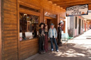
Enid on Allen Street, Tombstone, Arizona

Our RV park is right next to “downtown” Tombstone, so we walked around the old historic town today, and visited a number of different museums and exhibits.  We started at the old Cochise county courthouse, which is now a state historical site museum, and looked at the exhibits in it, which told some of the story of the area in the late 1800’s and early 1900’s.  Included in that part of the tour was a replica of the gallows that were used to hang a number of thieves and murderers.

Next we walked to the OK Corral and bought tickets for the gunfight show at 2 pm.  That allowed us to also view the historama, a combination of old diorama and video that told the story of Tombstone’s discovery and the history of mining and it’s eventual collapse.  It was interesting as an example of how multimedia presentations were done in the past with a rotating stage and animated diorama with action figures.

We then walked to the Epitaph, the old town newspaper, where we saw the printing presses and some of the history of the paper and the career of its editor, before walking back to the town park and eating our lunch.

After lunch we saw some of the exhibits in the OK Corral itself while waiting for the main show to begin.  They were pretty much what you’d expect to see in any old western town – a blacksmith forge, old wagons, the red light district, and so on.  The gunfight is acted out as a play, and for a melodrama, wasn’t bad.  Lots of arguments between the cowboys trying to show both sides of the story, and culminating in a thirty second gun battle.  We especially enjoyed the acting of the drunken Doc Holliday.

Posted in Going South, 2011 | Comments Off on Tombstone, Arizona, November 22

Leaving New Mexico, November 21

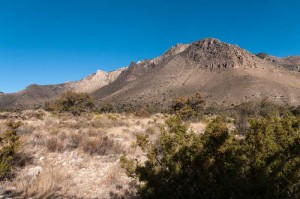
Guadalupe Mountains National Park, Texas

It was a long travel day today.  We left White’s City, New Mexico early this morning, and drove through El Paso, Texas and on to our destination of Tombstone, Arizona.  It was a very windy day, and mostly a headwind, so we managed to consume a lot of gas.

When we first left there were low gray clouds hanging overcast, but they soon cleared off and it became sunny.  Later in the afternoon we drove through a few light rainstorms, though we could see from water in the ditches that it had rained heavily in some places, and there were lightning storms around us.  We seemed to skirt the edge of most of them, except for the occasional very strong wind gusts.

The only stop we made, other than a few pit stops, was at Guadalupe National Park in Texas.  We only stopped for a few minutes there at the visitor center, but long enough to look at their display of mounted animals.  It looks like the park would be an interesting place to visit if we had more time.

Posted in Going South, 2011 | Comments Off on Leaving New Mexico, November 21

Carlsbad Caverns National Park, November 20

Carlsbad Caverns National Park, New Mexico

It’s only about 11 kilometers from here in White’s City to the caverns, so we were there in good time this morning.  We bought tickets for a guided tour of the “King’s Caverns” for the afternoon, and then headed into the line for the elevator.  We would have had to wait for at least one round trip, so I said to Enid, “let’s just walk down the natural entrance and come up on the elevator,” to which the lady handling the elevator queue said “that’s a very good idea.”

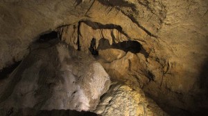
It’s a good thing we did that, as we had no idea that the natural entrance walk would be so remarkable.  You descend through the very large mouth of the cave down a fairly steep paved path of switchbacks.  It gradually gets darker and darker, until you are into the main part of the cave where they start to light the rock displays.  By this time you are several hundred feet underground, and continue on a general downward path until you have reached a depth of over 750 feet below the surface.  Nothing in what we had read or heard about the cave suggested that we would have missed a great experience if we hadn’t walked down this route.

Both Enid and I were astonished by the enormity of the cave.  The caverns are huge and the rock formations spectacular.  The ranger at the top had told us it would take forty five minutes to get to the bottom, but it took us a lot longer as we stopped so often to admire the rocks and video them.  By the time we got to the bottom it was after eleven o’clock, and so we decided to take the elevator back to the top and eat our lunch.

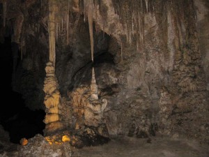
Chinese garden, Carlsbad Cavern's Big Room tour

After lunch we went back down on the elevator, and walked around the “Big Room” loop.  It is very big, more than a mile long, and full of enormous caverns and all kinds of cave formations.  We didn’t stop too much on the first part of the loop (there is a shortcut at roughly the half-way point) but continued on all the way to the end.  We thought we would come back and see the shortcut loop after our guided tour which started at two.

The ranger led tour of the King’s Palace wasn’t as far as the Big Room tour, but had some very magnificent formations.  You got a lot closer to them than in the other unguided parts of the cave.  When that part of our day was over it was three thirty, and they were soon closing the walks.  We did however spend almost another hour on the shortcut loop of the Big Room, and it was now much more peaceful as there was hardly anyone on the trails.

By the time we got back to the elevator they were closing things up and had roped off the entrances to the cave.  A young female ranger asked me how we enjoyed the cave, and I honestly replied that the day had been incredible.

Posted in Going South, 2011 | Comments Off on Carlsbad Caverns National Park, November 20

Across the Sacremento Mountains, November 19

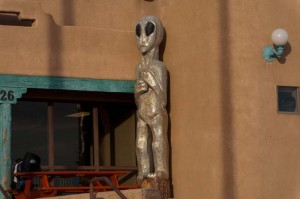
Alien sculpture, White's City, New Mexico

We hooked up the trailer to leave this morning and found a problem.  When I went to check the lights, the left turn signal was not working.  On investigation, I found that the wire from the truck to the trailer had been partially cut.  It must have gotten pinched in the hitch sometime when we drove in to the park at Oliver Lee.  I spliced together the three wires which were cut, and tried the lights again.  They still did not work.  I tried re-joining them, tried testing with the voltmeter with no luck, and finally listened to Enid’s advice that, “maybe a fuse is blown.”  I found that was correct when I checked the truck fuses, and fortunately we had a spare.  So after a delay of about an hour we managed to get away.

We drove north through Alamogordo.  The GPS insisted that we should turn to go a different route than we were heading, but we followed our instincts (and the road signs) instead.  We think it was probably taking us on a route that bypassed the city, but it would have meant backtracking some to get to it, so our route was probably just as fast.

Almost immediately after turning onto highway 82 just north of Alamogordo, we started to climb.  The road warns truckers not to use it, and it is pretty steep, climbing from the roughly 4000 foot level at Alamogordo, to over 8600 feet at Cloudcroft in a distance of 16 miles.  Cloudcroft is a ski resort area, but there was absolutely no snow on the ground, though we did see piles of sand and salt and graders – and lots of signs warning of icy roads.  The terrain here is very different than the desert, with large stands of ponderosa pine and a small stream that flowed along the road for a long way.

Then we coasted downhill for the next 100 kilometers or more into the town of Artesia which is an oil producing area, and smells strongly of hydrogen sulphide.  They have many large bronze sculptures in the town, one of an oil derrick and crew.  After that it was into Carlsbad, where once again our GPS took us on a strange route through the town, and on to White’s City.

“City” is hardly the correct term, as it consists of a restaurant, a motel, a small general store, and an RV park, and not much more.  However, it is just outside the Carlsbad Caverns National Park, and so serves to provide accommodation for that.  The clerk didn’t seem too excited about getting us registered, but he did do so.  You can tell you’re not too far from Roswell, as there were “alien” statues at buildings on both sides of the highway!

Posted in Going South, 2011 | Comments Off on Across the Sacremento Mountains, November 19

Dog Canyon Trail, November 18

White Sands from Dog Canyon Trail, New Mexico

We stayed in Oliver Lee memorial state park again today and hiked the Dog Canyon trail which starts behind the visitor center in the park.  The total trail is about 9 km long, and rises over 900 metres, but we didn’t go the whole way.  We hiked in to the remains of an old cabin about 4.8 km in and 470 m elevation gain.  The cabin is the stone walls of a small cabin, a “line” cabin, used when this area was still part of the Oliver Lee cattle ranch, and so-named because it was used at the end of the fence line in the canyon.

The part of the trail we did has a couple of very steep sections, one right near the start being especially steep and climbing up over some very bare and rough rock.  As it was perfectly dry the trail was ok, but it would be no fun coming down the bare rock if it was wet.  There are also a lot of rock steps in the trail.  I thought it would be tougher on the knees coming down than it was, so perhaps the stairs helped some.

After we got back we stopped in at the visitor center, where we got the explanation of the history behind the line cabin.  They have a number of displays of artifacts in a small museum.  One tells about “Frenchy” who had a very small cabin near the visitor’s center (I walked to it later).  They did an archaeological dig near his cabin, and had a number of artifacts in the center.  They also had a diorama display of  a battle between the US Cavalry and the Apaches.  Several battles took place in this canyon.

Another display was about Oliver Lee for whom the park is named.  He was an interesting character, who had a ranch here, and used the water that came from the small stream.  I walked along the trail they have near this stream and saw where he built a concrete sluice as part of the waterworks.  He also was tried (and acquitted) of murder, and had a shootout with Pat Garrett (the lawman who shot Billy the Kid).  We had stopped along the highway from Las Cruces when we came here two days ago at an historical sign talking about the dissapearance of “Colonel Fountain and his 8-year-old son Henry”.  It turns out the son’s murder is what Lee was charged with.  Eventually Lee was elected to the state senate.  We really are in the wild west here!

Posted in Going South, 2011 | Comments Off on Dog Canyon Trail, November 18

White Sands National Monument, November 17

White Sands National Monument

We spent the day in the white gypsum sand dunes of White Sands National Monument.  It was a nice day, a bit cool, but not too much wind.  There wasn’t enough wind to blow the sand around.

The dunes are very large, and very white.  Surprisingly, they are also very easy to walk on.  What water there is here in the New Mexico desert causes the gypsum to solidify (as it is plaster of paris) just below the surface, so in most places only the top one or two inches of sand are loose.  Below that it is hard enough to get good footing, so it was quite easy to climb up, especially in the areas where few people have travelled.  The more people walk on the sand the more the sub-surface crust breaks down, and so the softer the surface becomes.

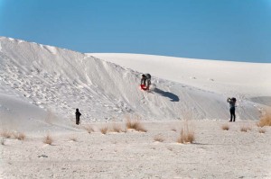
Sledding on the dunes, White Sands National Monument

We saw several people sledding on the sand.  They sell plastic saucers at the gift shop (and will buy them back when you are finished).  You can slide on the dunes, but they aren’t nearly as slippery as snow.

In the central dunes, where the wind causes the most dune movement (up to 30 feet per year) nothing is growing, and the dunes stretch as far as one can see.  In the hollow flats there are a few grasses.  Around the perimeter where the dunes don’t move so quickly, there are trees and agave plants that accommodate to the shifting sand by growing tall, and using the sub-surface moisture.  Then when the sand moves on they may die because they are no longer able to support themselves.

Posted in Going South, 2011 | Comments Off on White Sands National Monument, November 17

Oliver Lee Memorial State Park, Alamogordo, New Mexico, November 16

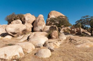
Rocks at Texas Canyon rest stop along I-10

We drove quite a way today, to the area of White Sands, New Mexico.  It was a nice day to drive, sunny, and not too windy.  We stopped at the Texas Canyon rest stop on I-10 where there were a number of very interesting rock formations.

We stopped just inside New Mexico at a tourist information site and got a free map.  From there we continued on eastward on mostly flat roads until we went through Las Cruces.  Here highway 70 climbs to an altitude of over 5700 feet and then drops down for a long way into the White Sands desert area.

Just before Alamogordo we had to go through a US border patrol checkpoint.  They only asked us one question, “What is your citizenship?” to which I replied “Canadian” and they said “Have a nice day” while they took a cursory look in the back of the Tahoe.

When we got to Alamagordo the GPS took us on a rather strange route to this park.  First it told us to turn where there was no road.  Then it told us to make a U-turn, but it was actually just a left turn.  The road we turned onto was paved at first, then after we turned south it changed to a rather rough gravel road with a lot of washes on it.  Eventually we got back onto a paved road, and arrived at this high desert campsite.  We filled up with water, but when we got to our site found that we have both power and water here, so we wouldn’t have needed to do that.

Oliver Lee Memorial State Park

It is a very nice evening.  It is dark here in the New Mexico desert, and the air is very clear so that the stars are very bright.  Overhead you can clearly see the Milky Way.

Posted in Going South, 2011 | Comments Off on Oliver Lee Memorial State Park, Alamogordo, New Mexico, November 16

Saguaro National Park, November 15

Saguaro National Park, Tucson, Arizona

It was a gorgeous day which we mostly spent cycling through Saguaro National Park West.  We drove to the park this morning, stopped at the visitor center to get some information, and then walked the short Cactus Garden Trail.  It’s supposed to be a 20 minute walk, but we took an hour as I shot a lot of video of the different kinds of cactus – saguaro, barrel, cholla – and some others which we don’t recognize and couldn’t identify.

Enid cycling, Saguaro National Park, Tucson, Arizona

We drove to the Sus picnic site where we unloaded our bikes and cycled around the Hohokam Road, a dirt road that is somewhat rough with washboard.  We climbed for the first half of the road, stopping a lot to take pictures, then started up the Golden Gate Road towards a picnic site where we planned to eat lunch.  It climbed steadily for a couple of kilometers, and we didn’t know how much farther it was to the picnic site, so we turned around and coasted downhill all the way to the Signal Hill picnic area.

After lunch there we hiked up to see the pictographs, and then continued on for a short ways along the same trail, before returning to our bikes and completing the loop back to our vehicle.

Unfortunately the rough ride on the road seems to have done some damage to my camera.  The internal sensor is shaking.  Some of the pictures seem to turn out, but others are unusable.  We aren’t certain if we can find a dealer in Tucson with a camera that I want to buy.  To be continued – maybe with less pictures ;-(

Posted in Going South, 2011 | Comments Off on Saguaro National Park, November 15

Historical Tucson, Botanical Gardens, November 14

Stage outside St. Augustine Cathedral, Tucson, Arizona

It was very foggy when we awoke this morning, but by about 9 am it had cleared so that we could see the mountains to the west.  We drove to downtown Tucson and walked around the historical presidio area.  We planned to go to the historical museum, but when we got there found that it was closed on Mondays.  Then we walked to the art museum, where we discovered the same thing!  Fortunately the church of St. Augustine was open, so we were able to go inside it, as well as walk around the grounds.

After we’d gone as far south as the Barrio Histórico District and seen some of the old adobe buildings there, we walked back to where we’d started, and toured a number of artisan shops.

Tucson botanical gardens

By now it was almost noon, so on a whim we searched the GPS for botanical gardens, and found that the Tucson Botanical Gardens were not too far away.  We drove there, and went in, where we ate our lunch.  Then we toured the butterfly greenhouse where they display many gorgeous tropical butterflies.  It was extremely hot and humid, so much so that our glasses and camera lenses fogged up badly.  After a while they cleared, and we enjoyed both the butterflies and the orchids in the greenhouse.

When we went back outside we walked through displays of a number of cacti and succulents from around the world.  They also have a section devoted to local Sonoran and Chihuahuan Desert plants.  We were back to our trailer by about 3 pm, and since it was such a nice afternoon we sat outside and read until suppertime.

Posted in Going South, 2011 | Comments Off on Historical Tucson, Botanical Gardens, November 14