It was raining very lightly this morning when we left, but it cleared as we headed farther south. We turned to the east at Helena, leaving the I15, and took the smaller highways (12, 287, I90 and 41) to bypass around the mountains. We re-entered I15 at Dillon. It was a nice trip, and has a much lower elevation profile since it avoids several mountain passes, though it is about 30 km longer than taking the I15 route.
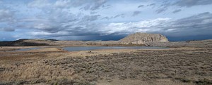
The trees along the Missouri River are very colourful in their fall foliage. This is ranching country. There are a large number of large, and very nicely maintained ranches along the highway. We stopped at a viewpoint at Beaverhead, where there is a large wetland that the ranch owners have let revert back to its natural state.
By this time it was sunny out, so we had a nice drive until we got about 50 km north of Idaho Falls. Then the wind got very strong and began to buffet the trailer. The wind has not died much yet and is rocking the trailer here in the campgrounds. We stopped at the Idaho Falls south tourist park, a free camping spot just above the dam on the lower Idaho Falls in the Snake River. It is a nice spot. The lower Idaho Falls are dammed just about 500 metres downstream on the river from this campsite. There are spaces laid out for ten or more RV sites, as well as a dump station. I’d found it by looking for free places to camp in Idaho Falls. It’s the first free site we’ve been to since we left Australia.
We walked along the river before supper. Though it’s not too cold (about 10 C) the wind wasn’t very pleasant to walk back into, and the forecast on the radio said it will freeze tonight.

