First this morning we drove in on the Bluff Point road. We came to a spot where the road forked, to the left to a lighthouse, and to the right a road that was marked on my GPS maps as going to the ocean. We went right, and did come to the ocean, actually to a bay where there were several cabins, and a number of people were launching boats. There were some small docks in the very calm bay. We didn’t stay, instead turned back and went to the lighthouse. The ocean was quite calm this morning, and although there looks to be a rocky reef that extends quite a way into the ocean, there was a large trawler style fishing boat which was coming in quite close to the shore.
We reached Stanley about 11 am. Along the way we passed a number of farms, with some very large herds of dairy cattle. I didn’t see anything much in the way of milking barns, though I suppose the weather is mild enough that they don’t need them.
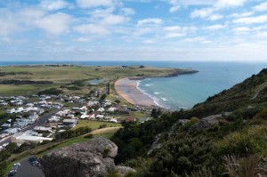
We climbed up “Circular Head”, also known as
“The Nut” after we’d made our lunch. It is a very steep climb of about 100 metres elevation. The trail was paved all the way, and they could make it switchback less steeply. However they also have a chairlift here, and it is incentive to the unfit not to take the steep route to the top. We ate our lunch about half way around on a lookout that faced the south.
After we descended we drove about three kilometres farther north to a restored historical site, “Highfield”. It is the site of the original Van Diemen’s Land Company in 1826. After an interesting hour there we travelled on to Burnie where we have stopped for tonight, and hope to see some fairy penguins this evening.

